- Usage in publication:
-
- Buckner formation
- Modifications:
-
- Named
- Dominant lithology:
-
- Anhydrite
- Shale
- Limestone
- AAPG geologic province:
-
- Gulf Coast basin
Summary:
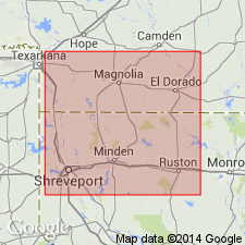
Named the Buckner formation for Buckner field, Columbia Co., AR. Consists of anhydrite with shale and dolomitic limestone. Overlies the Smackover limestone and underlies the Cotton Valley formation. Thickness is approximately 200 feet. The Buckner is of Late Jurassic age.
Source: GNU records (USGS DDS-6; Reston GNULEX).
- Usage in publication:
-
- Buckner formation
- Modifications:
-
- First used
- Dominant lithology:
-
- Anhydrite
- Shale
- Dolomite
- AAPG geologic province:
-
- Arkla basin
Summary:
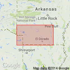
First? published description. Name applied to a subsurface unit in southern AR in the Arkla basin above the Reynolds oolite, an informal unit at the top of Smackover limestone (first? used). Unconformably underlies the Cotton Valley formation (first? detailed published description). Source of name, intent to name, and type locality not stated. Thickness varies due to truncation in pre-Cotton Valley time; maximum thickness penetrated is 270 ft; locally absent. Thickens basinward into northern LA. Basal 50-60 ft is white to pink anhydrite with streaks and partings of red shale, some streaks of dolomite, and argillaceous dolomite is gradational with Reynolds below. The overlying middle part is red shale with nodules of white to pink finely crystalline anhydrite. The upper 50 ft is red shale. Cross section; columnar section. Mesozoic age.
Source: GNU records (USGS DDS-6; Denver GNULEX).
- Usage in publication:
-
- Buckner formation
- Modifications:
-
- Areal extent
- AAPG geologic province:
-
- Arkla basin
- East Texas basin
- Mid-Gulf Coast basin
Summary:
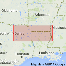
Pg. 578 (table 1), 592, strat. sections, chart. Buckner formation. Recognized in subsurface of northern Louisiana, southern Arkansas, eastern Texas, western Mississippi, and western Alabama. Underlies newly named Bossier formation of Cotton Valley group (rank raised). Overlies Smackover limestone. Age is Late Jurassic (early Kimmeridgian).
Source: US geologic names lexicon (USGS Bull. 1200, p. 515); supplemental information from GNU records (USGS DDS-6; Denver GNULEX).
- Usage in publication:
-
- Buckner Formation*
- Modifications:
-
- Revised
- AAPG geologic province:
-
- East Texas basin
- Arkla basin
Summary:
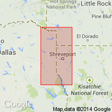
Used as a unit of formation rank and not as a basal member of Haynesville Formation (a term not used in this report). Includes rocks above Smackover Formation and below Cotton Valley Group. Is a persistent unit recognized in east TX in the East Texas basin and in adjoining AR and LA in the Arkla basin. Easily divided into a lower member predominately anhydrite, some red shale, and dolomite, and an upper member predominately red mudstone. Isopach maps; both members present in a belt across Cass and Bowie Cos, TX, East Texas basin into southern AR and northern LA, Arkla basin; lower member of most limited extent depositional axis parallels the edge of the Gulf Coast embayments. Formation thickness of 890 ft reported in Cass Co. Lower member 32 ft thick (between depths of 9,986 and 8,954 ft in Tidewater Oil Co., Talley #1 Bowie Co.) described as gray to brown, micro- to cryptocrystalline anhydrite interbedded with brown to gray dolomite, gray siltstone, brown mudstone, and shale. Upper member 250 ft thick (between depths of 10,568 and 10,818 ft in Arkansas-Louisiana Oil Co. M. Pitts, Caddo Parish) described as predominately gray, green, red shale with one gray siltstone bed and one brown partly oolitic limestone bed. Stratigraphic chart, cross section. Late Jurassic age.
Source: GNU records (USGS DDS-6; Denver GNULEX).
- Usage in publication:
-
- Buckner Formation
- Modifications:
-
- Contact revised
- AAPG geologic province:
-
- East Texas basin
Summary:
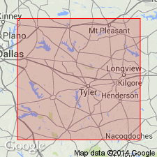
Lies in the shelfward area of northeast TX in the East Texas basin as a formation of the Louark Group. Is generally the same age as the Smackover Formation of Louark, though its lower part is younger than the Smackover; the two formations intertongue. Smackover is in part the basinward equivalent of the Buckner. Upper contact revised in that Buckner unconformably underlies the newly named Gilmer Limestone, upper formation of the Louark. Areal extent map of Gilmer. Rocks assigned to Gilmer were called "Cotton Valley limestone" or "Haynesville limestone" in earlier reports. E-log cross section. Correlation chart. Of Late Jurassic age.
Source: GNU records (USGS DDS-6; Denver GNULEX).
- Usage in publication:
-
- Buckner Formation
- Modifications:
-
- Areal extent
- Overview
- AAPG geologic province:
-
- Mid-Gulf Coast basin
Summary:
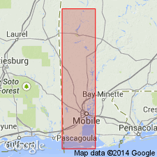
Buckner Formation extends around the northern Gulf of Mexico [now called Gulf of America], from south TX to FL. Revision to Member status by Philpot and Hazzard (1949) is rejected in this report as is the practice of restricting the Buckner to the basal anhydrite. The Buckner in AL is divisible into the following lithologies: 1) basal anhydrite, 2) interbedded anhydrite and shale, 3) massive halite, 4) evaporitic red beds, 5) evaporitic carbonate, and 6) arkosic sandstone. Overlies the Smackover Formation and underlies the Cotton Valley Group. Age is Late Jurassic (Oxfordian).
[Gulf of Mexico renamed Gulf of America (U.S. Board on Geographic Names per Presidential Executive Order 14172, issued January 20, 2025, and Department of Interior's Secretarial Order 3423, issued Feb. 7, 2025).]
Source: GNU records (USGS DDS-6; Reston GNULEX).
For more information, please contact Nancy Stamm, Geologic Names Committee Secretary.
Asterisk (*) indicates published by U.S. Geological Survey authors.
"No current usage" (†) implies that a name has been abandoned or has fallen into disuse. Former usage and, if known, replacement name given in parentheses ( ).
Slash (/) indicates name conflicts with nomenclatural guidelines (CSN, 1933; ACSN, 1961, 1970; NACSN, 1983, 2005, 2021). May be explained within brackets ([ ]).

