The National Geologic Map Database is migrating to a new infrastructure. We apologize for any service disruptions during this process.
|
|---|


- Usage in publication:
-
- Buckfield Group
- Modifications:
-
- Areal extent
- Dominant lithology:
-
- Schist
- Granulite
- AAPG geologic province:
-
- New England province
Summary:
Pg. 103, 104 (table 1), 105, figs. 1, 2, road log. Buckfield Group [noted as unpublished and unofficial stratigraphic name]. Composed of sillimanite-biotite rich schists and calc-silicate granulites. Comprises (ascending) Turner (new), Patch Mountain, Noyes Mountain, Berry Ledge, and Moody Brook Formations. Group has been traced northeastward [from Buckfield quadrangle] into large pluton in Farmington and Norridgewock quadrangles. Traced through Bryant Pond, Poland, and Lewiston quadrangles into Sebago pluton. Underlies Woodstock Group (new). Correlated with Waterville Formation of Osberg (in press) [P.H. Osberg, 1968, Maine Geol. Survey Bull., no. 20, 64 p.].
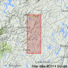
[Type locality and origin of name not stated. Area of report is Buckfield and Dixfield quadrangles, northwestern ME.]
Source: US geologic names lexicon (USGS Bull. 1350, p. 97); supplemental information from GNU records (USGS DDS-6; Reston GNULEX).
- Usage in publication:
-
- Buckfield Group
- Modifications:
-
- Not used
- AAPG geologic province:
-
- New England province
Summary:
Sangerville Formation used in place of Buckfield Group. Units formerly assigned to Buckfield, now members of Sangerville (ascending): Moody Brook, Berry Ledge, Noyes Mountain, Patch Mountain, and Turner Members. Overlies Anasagunticook Member of Waterville Formation. [Intent to revise the above units is not stated, but subdivision of the Sangerville and its lower contact are clearly shown in a stratigraphic column.] Order of younging within the Sangerville differs from reports of previous workers. Graded sequences suggest an inverted lithologic package.
Source: GNU records (USGS DDS-6; Reston GNULEX).
For more information, please contact Nancy Stamm, Geologic Names Committee Secretary.
Asterisk (*) indicates published by U.S. Geological Survey authors.
"No current usage" (†) implies that a name has been abandoned or has fallen into disuse. Former usage and, if known, replacement name given in parentheses ( ).
Slash (/) indicates name conflicts with nomenclatural guidelines (CSN, 1933; ACSN, 1961, 1970; NACSN, 1983, 2005, 2021). May be explained within brackets ([ ]).