The National Geologic Map Database is migrating to a new infrastructure. We apologize for any service disruptions during this process.
|
|---|


- Usage in publication:
-
- Buck tongue*
- Modifications:
-
- Original reference
- Dominant lithology:
-
- Shale
- AAPG geologic province:
-
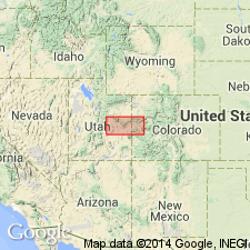
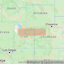
- Paradox basin
Summary:
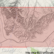
Buck tongue of Mancos shale. A westward-pointing tongue of Mancos shale, 0 to 350 feet thick, which in part of area [between Sunnyside and Colorado State line] wedges in between Sego and Castlegate sandstone members of Price River formation, of Mesaverde group. Not recognized northwest of Beckwith Plateau. Carries marine invertebrates of Lewis age. [Age is Late Cretaceous.]
Named from Buck Canyon, in T. 19 S., R. 23 E., [Antone Canyon 7.5-min quadrangle, Grand Co.], Book Cliffs, central eastern UT.
[GNC remark (ca. 1936, US geologic names lexicon, USGS Bull. 896, p. 283): This name first appeared in print in USGS Bull. 851, 1934, by C.E. Erdmann, in a report on eastern part of Book Cliffs coal field, where he treated the Buck tongue of Mancos shale as underlying Sego sandstone and overlying Castlegate sandstone, and gave its thickness as 360 feet. (See also 1932 correlation chart of Utah, compiled by M.G. Wilmarth.)]
Source: US geologic names lexicon (USGS Bull. 896, p. 283).
- Usage in publication:
-
- Buck tongue*
- Modifications:
-
- Areal extent
- AAPG geologic province:
-
- Paradox basin
Summary:
Used as a tongue of Mancos shale in central Book Cliffs, UT east of Green River, Paradox basin, as a unit between the Castlegate sandstone (below) and the Sego sandstone (above). Farther west it fingers into and is not separable from Price River formation. Increases in thickness eastward from about 100 ft in southern Beckwith Plateau to 350 ft at UT-CO line. Merges farther east with rest of Mancos as Castlegate sandstone disappears. Considerable variety of marine fauna (listed). Eight measured sections described. Is characteristically a gray shale that locally may be coaly, gypsiferous, and a buff sandstone. Columnar sections.
Source: GNU records (USGS DDS-6; Denver GNULEX).
- Usage in publication:
-
- Buck Tongue*
- Modifications:
-
- Revised
- AAPG geologic province:
-
- Green River basin
- Piceance basin
Summary:
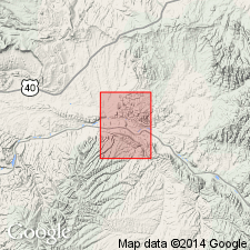
Buck Tongue of Mancos Shale revised to include Loyd Sandstone Bed. Loyd locally present westward but separately mapped only along west flank of Pinyon Ridge in north-central part of quad. Farther east, where Buck Tongue has merged with main body of Mancos, Loyd considered member of Mancos. Area of report is Rough Gulch quad, Rio Blanco and Moffat Cos, CO, Greater Green River basin and Piceance basin. Geologic map. Late Cretaceous age.
Source: GNU records (USGS DDS-6; Denver GNULEX).

- Usage in publication:
-
- Buck Tongue*
- Modifications:
-
- Age modified
- Revised
- AAPG geologic province:
-
- Paradox basin
Summary:
Is a unit of middle Campanian age (an age refinement) that overlies the Castlegate Sandstone and underlies the Bluecastle Tongue (removed from Price River and Neslen Formations and assigned to the Castlegate Sandstone) in the Paradox basin.
Source: GNU records (USGS DDS-6; Denver GNULEX).
- Usage in publication:
-
- Buck Tongue*
- Modifications:
-
- Revised
- AAPG geologic province:
-
- Piceance basin
Summary:
Buck Tongue in main body (informal) of Mancos Group. Recognized in subusurface of Douglas Arch,
Along with its Loyd Sandstone Bed, is assigned to main body of Mancos Group. Shown in subsurface from Douglas Creek arch area to area west of White River uplift, Rio Blanco Co, CO, Piceance basin. [Buck previously assigned to Mancos Shale. In eastern Uinta and western Piceance, Molenaar and Wilson, 1990 () raised rank of Mancos dividing it into, in ascending order, Mowry Shale, Frontier Formation and main body in upper part].
Source: GNU records (USGS DDS-6; Denver GNULEX).
For more information, please contact Nancy Stamm, Geologic Names Committee Secretary.
Asterisk (*) indicates published by U.S. Geological Survey authors.
"No current usage" (†) implies that a name has been abandoned or has fallen into disuse. Former usage and, if known, replacement name given in parentheses ( ).
Slash (/) indicates name conflicts with nomenclatural guidelines (CSN, 1933; ACSN, 1961, 1970; NACSN, 1983, 2005, 2021). May be explained within brackets ([ ]).