- Usage in publication:
-
- Buck Mountain Quartzite*
- Modifications:
-
- Named
- Dominant lithology:
-
- Quartzite
- Slate
- AAPG geologic province:
-
- Midcontinent region
Summary:
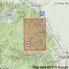
Named for Buck Mountain, its type locality, in sec 15, T2N, R5E, Pennington Co, SD in the Midcontinent region. Occurs in a linear outcrop belt in west part of mapped area from Lawrence Co in the north to Meade and Lawrence Cos in the south. Overlies Roberts Draw Limestone (new); underlies Gingrass Draw Slate (new), both formations of middle Precambrian age. Consists of thick-bedded orthoquartzite and quartzose slate with flaggy quartzite layers. Magnetic cherty ferruginous schist mapped near base. Of middle Precambrian age.
Source: GNU records (USGS DDS-6; Denver GNULEX).

- Usage in publication:
-
- Buck Mountain Quartzite*
- Modifications:
-
- Age modified
- Overview
- AAPG geologic province:
-
- Midcontinent region
Summary:
Mapped with two Early Proterozoic units (Xgb, Xq, pl. 1) in the Nemo area, Lawrence Co, Midcontinent region of SD. Thought to be about 2.0 Ga and a correlative of the Ellison Formation of the Lead area. Iron-formation at base of Buck Mountain may be correlative with Homestake Formation. Also called Buck Mountain Formation. Geologic map.
Source: GNU records (USGS DDS-6; Denver GNULEX).
For more information, please contact Nancy Stamm, Geologic Names Committee Secretary.
Asterisk (*) indicates published by U.S. Geological Survey authors.
"No current usage" (†) implies that a name has been abandoned or has fallen into disuse. Former usage and, if known, replacement name given in parentheses ( ).
Slash (/) indicates name conflicts with nomenclatural guidelines (CSN, 1933; ACSN, 1961, 1970; NACSN, 1983, 2005, 2021). May be explained within brackets ([ ]).

