

- Usage in publication:
-
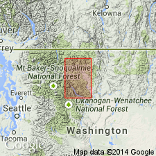
- Buck Mountain Formation
- Modifications:
-
- Named
- Biostratigraphic dating
- Dominant lithology:
-
- Volcanics
- Volcaniclastics
- AAPG geologic province:
-
- Okanogan province
Summary:
Unit is named as one of two formally named members of Newby Group. Type section designated as exposures 1.6 km east of summit of Buck Mountain at Buck Lake, sec. 22, T36N R21E, to ridge separating Second and Third Creeks, sec. 29, T26N R21E, Okanogan Co., WA. Divided into 3 unnamed units. Lowest unit consists of predominantly andesitic breccia, with a few interbedded siltstones-sandstones, and a few vesicular to amygdaloidal but more commonly massive flows. The middle unit is composed of lithic sandstones, siltstones, and black shales in which lenticular beds of conglomerate occur. Uppermost unit consists of dark-gray volcanic lithic sandstone, siltstone, and black shale. Is 4420 m thick. Unconformably overlies the Twisp Formation (new). Unconformably underlies the Goat Creek Formation (new). Age is Early Cretaceous (Hautervian-Barremian) based on fossils [belemnites, ammonites and pelecypods].
Source: GNU records (USGS DDS-6; Menlo GNULEX).
For more information, please contact Nancy Stamm, Geologic Names Committee Secretary.
Asterisk (*) indicates published by U.S. Geological Survey authors.
"No current usage" (†) implies that a name has been abandoned or has fallen into disuse. Former usage and, if known, replacement name given in parentheses ( ).
Slash (/) indicates name conflicts with nomenclatural guidelines (CSN, 1933; ACSN, 1961, 1970; NACSN, 1983, 2005, 2021). May be explained within brackets ([ ]).