- Usage in publication:
-
- Bryan sand [unranked]
- Modifications:
-
- Original reference
- Dominant lithology:
-
- Sand
- AAPG geologic province:
-
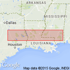
- Gulf Coast basin
Summary:
Pg. 853 (fig. 131), 856 [1940]. Byran sand [unranked] in Yegua formation. Lenticular body of sand at base of Yegua formation. Overlies Mount Tabor member (new) of Crockett formation. Discussion of Yegua problem; author favors placing Crockett-Yegua boundary at base of Bryan sand. [Age is Eocene (Claiborne).]
Type locality: along State Highway 21 from 2.1 to 3.75 mi west of court house, Brazos Co., east-central TX.
Source: US geologic names lexicon (USGS Bull. 1200, p. 508-509).
- Usage in publication:
-
- Bryan sandstone
- Modifications:
-
- Revised
- AAPG geologic province:
-
- Gulf Coast basin
Mathews, A.A.L., 1950, Geology of Brazos County, Texas: Texas Engineering Experiment Station Research Report, no. 14, 14 p.
Summary:
Pg. 3, geol. map. Bryan sandstone of Yegua group. At type locality, medium- to coarse-grained, well-sorted, irregularly bedded, coarsely laminated, uniformly cross-bedded nearly white sandstone of characteristic deltaic origin. Locally, includes an 8-inch red iron sandstone bed. Contains petrified wood. Estimated thickness 553 feet. Lenticular along strike but not absent except where cut out by faulting. Overlies Smetana sandstone (new); underlies Easterwood shales (new). [Age is Eocene (Claiborne).]
Source: US geologic names lexicon (USGS Bull. 1200, p. 508-509).
For more information, please contact Nancy Stamm, Geologic Names Committee Secretary.
Asterisk (*) indicates published by U.S. Geological Survey authors.
"No current usage" (†) implies that a name has been abandoned or has fallen into disuse. Former usage and, if known, replacement name given in parentheses ( ).
Slash (/) indicates name conflicts with nomenclatural guidelines (CSN, 1933; ACSN, 1961, 1970; NACSN, 1983, 2005, 2021). May be explained within brackets ([ ]).

