

- Usage in publication:
-
- Brushy Knob Formation
- Modifications:
-
- Named
- Reference
- Dominant lithology:
-
- Sandstone
- Shale
- AAPG geologic province:
-
- Ouachita folded belt
- Arkoma basin
Summary:
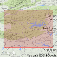
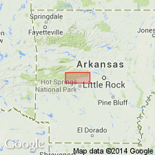
Named as upper formation of Jackfork Group in western AR for exposures in secs 13, 14, 15, 16, T1S, R28W, Polk Co, AR in the Ouachita tectonic belt province. These exposures are the type locality (also called type section). Reference locality [not described] is along Mill Creek Mountain, T1N, R27W, Montgomery Co. Basal contact is with Irons Fork Mountain Formation (new) of Jackfork Group. Contact placed at top of gray soft shale (Irons Fork Mountain) with massive ridge-forming, gray to white, generally fine- to medium-grained sandstone (Brushy Knob). Consists of massive light-gray to thinner bedded dark-gray sandstone and gray "mudrocks" [shale and mudstone]. Granules and pebbles of quartz and chert present locally as discontinuous seams. Floating sand grains and carbonaceous matter found in the mudrocks. Is older than the Johns Valley Shale of Mississippian and Pennsylvanian age. Upper contact poorly exposed. Correlation chart; measured sections. Of Mississippian age.
Source: GNU records (USGS DDS-6; Denver GNULEX).
- Usage in publication:
-
- Brushy Knob Formation
- Modifications:
-
- Age modified
- AAPG geologic province:
-
- Ouachita folded belt
- Arkoma basin
Summary:
Age of Jackfork Group, and hence its Irons Fork Mountain and Brushy Knob Formations, is based on presence of Pitkin fossils (Mississippian) in reworked limestone boulders in underlying Chickasaw Creek Formation, upper formation of Stanley Group. Jackfork and its formations are thought to be of Morrowan or Early Pennsylvanian age, rather than Mississippian age, in western AR in the Ouachita tectonic belt province and in the Arkoma basin. Massive sandstones of Brushy Basin stand high above the valley-forming soft shale of the Irons Fork Mountain Formation. The upper contact with Johns Valley Formation is conformable.
Source: GNU records (USGS DDS-6; Denver GNULEX).
For more information, please contact Nancy Stamm, Geologic Names Committee Secretary.
Asterisk (*) indicates published by U.S. Geological Survey authors.
"No current usage" (†) implies that a name has been abandoned or has fallen into disuse. Former usage and, if known, replacement name given in parentheses ( ).
Slash (/) indicates name conflicts with nomenclatural guidelines (CSN, 1933; ACSN, 1961, 1970; NACSN, 1983, 2005, 2021). May be explained within brackets ([ ]).