

- Usage in publication:
-
- Bruin Limestone Member*
- Modifications:
-
- Named
- Dominant lithology:
-
- Limestone
- Siltstone
- Chert
- AAPG geologic province:
-
- Alaska Peninsula province
- Alaska Southwestern region
Summary:
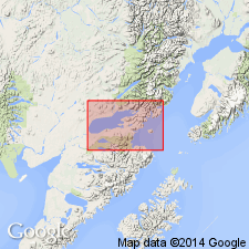
Type locality: exposures on peninsula on south side of Bruin Bay which opens into Kamishak Bay, Iliamna quad, Alaska Peninsula, AK. Named as member of Kamishak Formation. Consists of gray, black, and green limestone with calcareous siltstone and banded chert beds. Forms highly crumpled beds, fossil fragments and reef-like bioherm; chert forms prominent cliffs. Is over 610 m thick. Overlies Cottonwood Bay Greenstone; underlies unnamed middle member of Kamishak Formation. Is Late Triassic age.
Source: GNU records (USGS DDS-6; Menlo GNULEX).
For more information, please contact Nancy Stamm, Geologic Names Committee Secretary.
Asterisk (*) indicates published by U.S. Geological Survey authors.
"No current usage" (†) implies that a name has been abandoned or has fallen into disuse. Former usage and, if known, replacement name given in parentheses ( ).
Slash (/) indicates name conflicts with nomenclatural guidelines (CSN, 1933; ACSN, 1961, 1970; NACSN, 1983, 2005, 2021). May be explained within brackets ([ ]).