

- Usage in publication:
-
- Browns Park group*
- [Browns Park formation*]
- Modifications:
-
- Original reference
- Dominant lithology:
-
- Sandstone
- Conglomerate
- Limestone
- AAPG geologic province:
-
- Uinta basin
Summary:
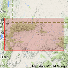
Pg. 40, 44, 168. Brown's Park group [Browns Park formation]. Sandstones, gravel, limestones, concretionary and stratified flints, 0 to 1,800 feet thick. In some places conglomerates having a great development are found at base. Unconformably underlies Bishop Mountain conglomerate [according to geologic column on p. 40, but according to later pages the two formations do not appear to be in contact]. Unconformably overlies Bridger group and older rocks. Well represented at Brown's Park, northeastern Utah and northwestern Colorado, and in a district stretching to southwest beyond Snake and Yampa rivers. [The early writers used group in sense that modern writers use formation. The Browns Park "group" of Powell is same as Browns Park formation of present nomenclature, the true Uinta formation (DIPLACODON zone), which overlies Bridger formation in Uinta basin (south of Uinta Mountains), being absent in northeast Utah and northwest Colorado.]
[GNC remark (ca. 1938, US geologic names lexicon, USGS Bull. 896, p. 275): For many years Browns Park formation of east end of Uinta Mountains, in northeast Utah and northwest Colorado, was supposed to be same as Uinta formation of Uinta basin, which lies to south of Uinta Mountains, and the two names were used interchangeably.]
Source: US geologic names lexicon (USGS Bull. 896, p. 275).
- Usage in publication:
-
- Browns Park Formation
- Modifications:
-
- Overview
- AAPG geologic province:
-
- Green River basin
Summary:
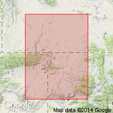
Deposition began soon after Bishop Conglomerate, perhaps with no hiatus. Chalky tuff at base dated at 25 m.y. or Oligocene. Tuffs higher in formation are 8-12 m.y. old, or Miocene. Varied lithology due to nearby tectonic activity. Consists of nearly white, loosely cemented, generally calcareous sandstone and light-gray to white, vitric and ashy to earthy, friable to firm, rhyolitic tuff. Some of sandstone is eolian, and cross-stratified. Source of sandstone not determined; could be Bishop. Is of fluvial origin in Browns Park valley. Also includes bedded chert, minor amounts of limestone and marlstone, some of which is oolitic, siltstone, and lacustrine clay, and locally derived conglomerate at several levels. Source of tuffs unknown. Direction of drainage reversed after Bishop time from south to north in Browns Park time. Shown as present in Greater Green River basin and Uinta uplift, but absent in northern Uinta basin.
Source: GNU records (USGS DDS-6; Denver GNULEX).
- Usage in publication:
-
- Browns Park Formation*
- Modifications:
-
- Geochronologic dating
- AAPG geologic province:
-
- Uinta uplift
- Green River basin
Summary:
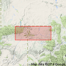
The following new radiometric age determinations on tuffs are fission track ages of 8.25 +/-0.7 m.y. and 8.6 +/-0.8 m.y. from the upper part of the formation. The oldest age reported is 23.8 +/-0.8 on deposits 30 m above the base); the youngest age is 7.2+/-0.6 m.y.. Has many as 31 tuffaceous horizons in northeast UT (Uinta uplift) and northwest CO (Greater Green River basin). Many of these horizons were reworked and redeposited ash. Possible source area for the ash was in the Basin-and-Range which was a volcanically active area in Browns Park time. Assigned to the late Oligocene to late Miocene.
Source: GNU records (USGS DDS-6; Denver GNULEX).
- Usage in publication:
-
- Browns Park Formation*
- Modifications:
-
- Areal extent
- Geochronologic dating
- Biostratigraphic dating
- AAPG geologic province:
-
- Green River basin
Summary:
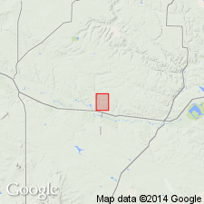
Mapped on north and south flanks of Uinta Mountains, UT (on Uinta uplift) and CO, west flank of Park Range, Sierra Madre, White River plateau, CO and Poison basin, WY (in the Greater Green River basin). Divided into basal conglomerate unit (composed of fragments from Uinta Mountain Group, Paleozoic carbonates, chert), white cross-bedded sandstone unit, white parallel bedded sandstone unit, and tan unit that total about 600 m thick. Volcanic ash beds (white, vitric, friable) several cm to several m thick occur locally in the formation. A 23.3 +/-3.7 m.y. date obtained from one ash bed near base and a 11.3+-0.8 m.y. date (Zr F-T) obtained from one in higher part. Overlies older formations of Precambrian to middle Eocene age. Was deposited in a paleovalley cut on the Uinta arch. Is of eolian origin (deposited by winds blowing from southwest) and of fluvial origin (deposited by an ancestral Yampa river). Has fossil mammals (dog, camel antilocaprid). Two local faunas named; 1.) Cross Mountain fauna of early to late Hemingfordian age and 2.) Cedar Springs Draw fauna of late Barstovian to early Clarendonian age. Assigned to the late Oligocene and Miocene.
Source: GNU records (USGS DDS-6; Denver GNULEX).
For more information, please contact Nancy Stamm, Geologic Names Committee Secretary.
Asterisk (*) indicates published by U.S. Geological Survey authors.
"No current usage" (†) implies that a name has been abandoned or has fallen into disuse. Former usage and, if known, replacement name given in parentheses ( ).
Slash (/) indicates name conflicts with nomenclatural guidelines (CSN, 1933; ACSN, 1961, 1970; NACSN, 1983, 2005, 2021). May be explained within brackets ([ ]).