- Usage in publication:
-
- Bromide formation
- Modifications:
-
- Original reference
- AAPG geologic province:
-
- South Oklahoma folded belt
Summary:
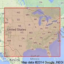
Pl. 27. Showed a new formation, called Bromide, of Black River and uppermost Chazy age, as overlying, in places unconformably, Simpson formation (restricted), and unconformably underlying Viola limestone, in Arbuckle Mountains, Oklahoma, the typical region of the Simpson and the Viola. As originally defined and used up to this time the Viola rested on the Simpson. Age is Middle Ordovician.
Source: US geologic names lexicon (USGS Bull. 896, p. 270-271).
- Usage in publication:
-
- Bromide group
- Modifications:
-
- Revised
- Dominant lithology:
-
- Limestone
- Sandstone
- AAPG geologic province:
-
- South Oklahoma folded belt
Summary:
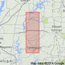
Pg. 967-975. Simpson formation divided into Bromide group above and "Wilcox" sand below. The Bromide is a series of magnesium limes and sands, in places interbedded with small amounts of green shale. Thickness 315 to 495 feet in Arbuckle Mountains; 0 to 600 feet in Midcontinent field. The descriptive term "post-Wilcox" was applied by Luther White to these beds to indicate that part of Simpson formation which is younger than "Wilcox" sand. Ulrich (1911) classified Bromide formation as occurring between Simpson formation and Viola limestone. Taff mapped type locality of Bromide formation, near Bromide, [in] sec. 19, T. 1 S., R. 8 E., as lower Viola limestone. This outcrop was visited recently by a party of geologists under direction of Oklahoma Geological Survey, and all present agreed that this outcrop is made up of sediments that in every way resemble the "post-Wilcox" well cuttings. It is suggested by Luther White, the writer, and others that term "post-Wilcox" be dropped and that Bromide be retained to designate the group of sediments that occurs between "Wilcox" sand and Viola lime.
Source: US geologic names lexicon (USGS Bull. 896, p. 270-271).
- Usage in publication:
-
- Bromide division
- Modifications:
-
- Revised
- Biostratigraphic dating
- AAPG geologic province:
-
- South Oklahoma folded belt
Summary:
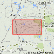
Pg. 21-32. Simpson formation of Taff comprises at least 3 faunas of exceedingly diverse origin and geographic distribution. None of these faunas, nor any beds that might contain them, are found in southern Missouri or Arkansas. The closing stage, provisionally added to top of Bromide division of Simpson, contains a good representative of Decorah and Prosser faunas of Minnesota (Black River and lower Trenton). Typical Bromide is of late Chazy age [and is shown as constituting topmost part of Simpson formation].
Source: US geologic names lexicon (USGS Bull. 896, p. 270-271).

- Usage in publication:
-
- Bromide formation
- Bromide [beds]
- Modifications:
-
- Overview
- AAPG geologic province:
-
- South Oklahoma folded belt
Summary:
In manuscript chart dated April 1928 (but not published by him) E.O. Ulrich divided Simpson formation of Taff into (descending): (1) West Spring Creek formation, Criner member (of Trenton and Black River age); unconformably on (2) Bromide formation; and (3) Oil Creek formation, the latter having great unconformity at base.
At Dec. 1928 meeting of GSA, in New York, Ulrich exhibited a manuscript chart (which he did not publish) in which he divided Simpson formation into (descending) "Bromide", "Criner", "Tulip Creek", McLish, Falls, Nebo, and "Joins Ranch", as reported by Dr. C.N. Gould. Ulrich's 1928 list of names as reported by Gould was published by C.E. Decker in Dec. 1930 (AAPG Bull., v. 14, no. 12, p. 1496).
E.O. Ulrich (letter dated Nov. 11, 1929; published by C.E. Decker in Oklahoma Geol. Survey Bull., no. 55, p. 40, 1931) stated "As used by me in past 2 years the Bromide includes all beds of Black River and Trenton ages that were deposited in Arbuckle region."
In Feb. 1930 (US Natl. Mus. Proc., v. 76, art. 21, p. 73) Ulrich divided Simpson formation into (descending): "Bromide" (of Trenton and Biack River age) unconformable on "Criner"; "Tulip Creek", Falls, McLish, "Oil Creek", and "Joins".
Source: US geologic names lexicon (USGS Bull. 896, p. 271, 2312).
- Usage in publication:
-
- Bromide formation
- Modifications:
-
- Areal extent
- AAPG geologic province:
-
- South Oklahoma folded belt
Summary:
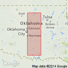
Pg. 1498-1505. Bromide formation. Chiefly limestones, some shale, some sandstone, with a sandstone of variable thickness at base. Thickness of formation 171 to 600+/- feet. Of Trenton and Black River age. Ovelries Tulip Creek formation and underlies Viola limestone. As Bromide has been used more extensively in connection with the Simpson it seems best to retain it for the upper formation and drop Criner.
Source: US geologic names lexicon (USGS Bull. 896, p. 270-271).
- Usage in publication:
-
- Bromide formation
- Modifications:
-
- Revised
- AAPG geologic province:
-
- South Oklahoma folded belt
Summary:
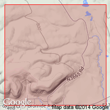
Pg. 947. Bromide formation is overlain, with angular unconformity, by Viola limestone, and underlain, with angular unconformity, by Tulip Creek formation.
Source: US geologic names lexicon (USGS Bull. 896, p. 270-271).
- Usage in publication:
-
- Bromide formation
- Modifications:
-
- Revised
- AAPG geologic province:
-
- South Oklahoma folded belt
Summary:
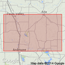
Pg. 11-12, 98. The Simpson is here raised to a group, divided into 5 formations (ascending): Joins, Oil Creek, McLish, Tulip Creek, and Bromide. Heretofore Bromide, in various tables, has been used to represent a number of different horizons, but its last use was to limit it to upper part of section exposed in hill just west of the hotel at Bromide, and it was thought that the fauna represented in this section was yonnger than that found in upper part of Simpson elsewhere. Further studies of a section above tbe 3 artesian wells at northeast edge of Bromide, and sections on Robertson Ranch about 3 miles south of Bromide, have contributed evidence to show that certain parts of fauna and the physical characteristics of upper part of the Simpson at east end of mountains are almost identical with those of upper part of Simpson in most of its outcrops. As Bromide has been used more extensively and longer in connection with the Simpson, it is thought better to retain it as the name for upper formation of this group and drop Criner, which was at first the name of a member, but later was raised to formation name before it was realized the fauna at Rock Crossing in Criner Hills is largely a duplication of upper Simpson fauna to the north, with addition of several apparently local forms.
Named from town of Bromide, Johnston Co., wbere type section was made on a hill northwest of Galbraith Hotel.
Source: US geologic names lexicon (USGS Bull. 896, p. 270-271).
- Usage in publication:
-
- Bromide formation
- Modifications:
-
- Areal extent
- AAPG geologic province:
-
- South Oklahoma folded belt
Summary:
Pg. 105. Bromide formation included in Simpson group. Typical Bromide correlates with Lowville.
Source: US geologic names lexicon (USGS Bull. 896, p. 270-271).
- Usage in publication:
-
- Bromide formation
- Modifications:
-
- Overview
- AAPG geologic province:
-
- South Oklahoma folded belt
Summary:
Pg. 655-656, measured sections. Outcrops are more widespread than those of any other formation of Simpson group. Measured sections show thickness varies from 87.5 feet to 674.5 feet. Uppermost formation of group; overlies Tulip Creek formation.
Source: US geologic names lexicon (USGS Bull. 1200, p. 489).
- Usage in publication:
-
- Bromide formation*
- Modifications:
-
- Overview
- Age modified
- Biostratigraphic dating
- AAPG geologic province:
-
- South Oklahoma folded belt
Summary:
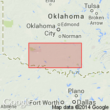
Pg. 413-436. Formation, as used in this report, is same as that defined and mapped by Decker and Merritt (1931, Oklahoma Geol. Survey Bull., no. 55) and thus includes typical Bromide, Criner, and Cool Creek formations of Ulrich. At type section, herein described for first time, formation includes 15 beds with total thickness of 127.5 feet; underlies Viola limestone; base of section covered. Evidence presented by bryozoa suggests lower Trenton age, and fauna is closely allied to Decorah of Minnesota. Review of previous stratigraphic work.
Source: US geologic names lexicon (USGS Bull. 1200, p. 489).
- Usage in publication:
-
- Bromide formation*
- Modifications:
-
- Age modified
- Biostratigraphic dating
- AAPG geologic province:
-
- South Oklahoma folded belt
Summary:
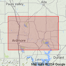
Pg. 694-695. Black River age on basis of cystids.
Source: US geologic names lexicon (USGS Bull. 1200, p. 489).
- Usage in publication:
-
- Bromide formation
- Modifications:
-
- Age modified
- Biostratigraphic dating
- AAPG geologic province:
-
- South Oklahoma folded belt
Summary:
Pg. 100, 135 (table 5). Discussion of Athens graptolites in Bromide formation. Trenton in age.
Source: US geologic names lexicon (USGS Bull. 1200, p. 489).
- Usage in publication:
-
- Bromide formation*
- Modifications:
-
- Age modified
- Biostratigraphic dating
- AAPG geologic province:
-
- South Oklahoma folded belt
Summary:
Pg. 120-123, chart 1. Bromide formation. Consists of sandstone, shale, and limestone, latter predominating at least in upper part. Thickest at west end of Arbuckle Mountains where it measures 647 feet. Subdivided into two members: Mountain Lake below and Pooleville above (both new). Overlies Tulip Creek formation; underlies Viola formation. Bromide has been variously placed from Chazyan to Trenton. Brachiopod evidence does not support Loeblich's (1942) conclusion of a lower Trenton age. Chart shows Bromide spans interval from upper part of Chazyan to upper part of Bolarian.
Source: US geologic names lexicon (USGS Bull. 1200, p. 489).
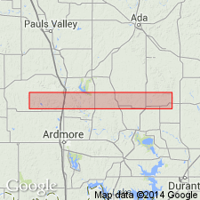
- Usage in publication:
-
- Bromide formation
- Modifications:
-
- Age modified
- Biostratigraphic dating
- AAPG geologic province:
-
- South Oklahoma folded belt
Summary:
Pg. 84-94, fig. 1, charts 1, 2. Loeblich (1942) measured and described type section. Topmost 10 to 18 feet of dense, thin-bedded limestone of Loeblich's beds 2 and 3 are quite probably Corbin Ranch formation (new) of this report. Also, it is quite possible that lower part of section (plus covered section at base) involves some normal or faulted Tulip Creek strata. U.S. Highway 77 Bromide section is 427 feet thick and subdivisible into a 55- to 60-foot basal sandstone and a 370-foot section of overlying shales and limestones; West Spring Creek section is 420 feet thick and subdivisible into same basal sandstone 60 to 75 feet thick, and overlying shale and limestone section 355 feet thick. Disconformable contact with both underlying Tulip Creek and overlying Corbin Ranch. Ostracoda discussed. Fossils indicate an age essentially Blackriverian.
Source: US geologic names lexicon (USGS Bull. 1200, p. 489).
For more information, please contact Nancy Stamm, Geologic Names Committee Secretary.
Asterisk (*) indicates published by U.S. Geological Survey authors.
"No current usage" (†) implies that a name has been abandoned or has fallen into disuse. Former usage and, if known, replacement name given in parentheses ( ).
Slash (/) indicates name conflicts with nomenclatural guidelines (CSN, 1933; ACSN, 1961, 1970; NACSN, 1983, 2005, 2021). May be explained within brackets ([ ]).

