- Usage in publication:
-
- Broken Rib Member
- Modifications:
-
- Named
- Dominant lithology:
-
- Dolomite
- Limestone
- AAPG geologic province:
-
- Piceance basin
- Green River basin
- Eagle basin
Summary:
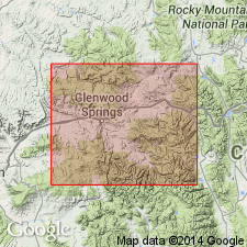
Named as lower of two members of Dyer Formation (revised, redescribed) of Chaffee Group (revised). Type area is on east side of Grizzly Creek, 1.5 mi south of its confluence with Broken Rib Creek (for which unit probably named). Measured section 14 (not figured) in type area is in sec 2, T5S, R88W, Garfield Co, CO. Unit occurs in Rio Blanco and Garfield Cos, Piceance basin; Routt Co, Greater Green River basin; and Eagle and Pitkin Cos, Eagle basin. Consists of gray to dark-gray dolomitic limestone (micrite) with some beds of almost pure dolomite; contains fine to coarse fossil fragments (mostly pelmatozoan plates and columnals) as well as complete fossils (mostly brachiopods). Fossil assemblage is CYRTIOPSIS-PAURORHYNCHA fauna. Rounded outcrop commonly forms a cliff; outcrops are characterized by very thick massive beds and knobby weathered surface. Isopach map shows unit thickening to west and ranges up to about 80 ft thick. Conformably overlies Parting Formation (revised) with gradational contact; conformably underlies Coffee Pot Member (new) of Dyer with sharp to gradational contact. To east in direction of thinning, Broken Rib intertongues with Coffee Pot. Measured section; fence diagram. Late Devonian (Famennian) age based on fossils.
Source: GNU records (USGS DDS-6; Denver GNULEX).
For more information, please contact Nancy Stamm, Geologic Names Committee Secretary.
Asterisk (*) indicates published by U.S. Geological Survey authors.
"No current usage" (†) implies that a name has been abandoned or has fallen into disuse. Former usage and, if known, replacement name given in parentheses ( ).
Slash (/) indicates name conflicts with nomenclatural guidelines (CSN, 1933; ACSN, 1961, 1970; NACSN, 1983, 2005, 2021). May be explained within brackets ([ ]).

