

- Usage in publication:
-
- Broad Ford sandstone
- Modifications:
-
- Original reference
- Dominant lithology:
-
- Sandstone
- AAPG geologic province:
-
- Appalachian basin
Summary:
Broad Ford sandstone. A very prominent red sandstone with distinctive lithology and marine fossils. Occurs a few feet below Langhorne coal in Poverty Gap and is traceable for several hundred miles through Appalachian region. Thickness 230 feet.
Named for its best exposure in Smyth Co., southwestern VA.
Source: US geologic names lexicon (USGS Bull. 896, p. 269-270).
- Usage in publication:
-
- Broad Ford sandstone
- Modifications:
-
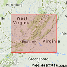
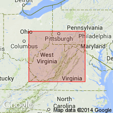
- Areal extent
- Overview
- AAPG geologic province:
-
- Appalachian basin
Summary:
Broad Ford sandstone is described as a usually reddish brown, occasionally greenish gray or rusty ledge. Usually thick bedded and frequently hard but often shaly and weathering to concretionary or chunky blocks. Contains marine fossils in several zones. Thickness 50 to 300 ft. Lies a few ft below Langhorne coal and 25 to 100 ft above Sunbury shale, all included in Pocono series. Type locality designated at line between Smyth and Tazewell Cos., VA, about 0.5 mi north of Broad Ford Village. Also observed in Montgomery and Giles Cos., VA, and in Mercer, Monroe, Greenbrier, and Summers Cos, WV, and into PA, through Pocahontas and Preston Cos. Age is Mississippian.
Source: GNU records (USGS DDS-6; Reston GNULEX).
- Usage in publication:
-
- Broad Ford sandstone
- Modifications:
-
- Overview
- AAPG geologic province:
-
- Appalachian basin
Summary:
Unit generally included in the Pocono, but its Mississippian age at type locality has been doubted. [Some workers assign it to the Devonian.] Shown on correlation chart in Pocono series (Kinderhookian) below Lindside sandstone and above Sunbury shale.
Source: GNU records (USGS DDS-6; Reston GNULEX).
- Usage in publication:
-
- Broadford sandstone
- Modifications:
-
- Overview
- AAPG geologic province:
-
- Appalachian basin
Summary:
Broadford [Broad Ford] is unfossiliferous at its type locality. By use of stratigraphic position and key beds, the unit has been located in six measured sections northeast of Broadford, and in each a Conewango fauna has been found. Generally the real Broadford sandstone in VA has been mapped as part of Chemung formation, and younger Mississippian units have been mistakenly identified as the Broadford.
Source: GNU records (USGS DDS-6; Reston GNULEX).
- Usage in publication:
-
- Broad Ford Sandstone
- Modifications:
-
- Not used
- AAPG geologic province:
-
- Appalachian basin
Summary:
Lindside and Broad Ford Sandstones of Reger (1926) should be abandoned. Broad Ford cannot be reliably correlated outside its type area of southwestern VA. Has been beset with differing age designations, though clearly meant to be Mississippian.
Source: GNU records (USGS DDS-6; Reston GNULEX).
For more information, please contact Nancy Stamm, Geologic Names Committee Secretary.
Asterisk (*) indicates published by U.S. Geological Survey authors.
"No current usage" (†) implies that a name has been abandoned or has fallen into disuse. Former usage and, if known, replacement name given in parentheses ( ).
Slash (/) indicates name conflicts with nomenclatural guidelines (CSN, 1933; ACSN, 1961, 1970; NACSN, 1983, 2005, 2021). May be explained within brackets ([ ]).