The National Geologic Map Database is migrating to a new infrastructure. We apologize for any service disruptions during this process.
|
|---|


- Usage in publication:
-
- Britt granodiorite*
- Modifications:
-
- Informally named
- Dominant lithology:
-
- Granodiorite
- Monzodiorite
- AAPG geologic province:
-
- Lake Superior province
Summary:
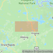
Informally named as a component of the central part of the Giants Range batholith, northeastern MN, Lake Superior province. Giants Range batholith is a multicomponent intrusive complex of Late Archean age exposed between Ely and Grand Rapids, MN, in western part of Wawa Subprovince of Superior Province. Britt intrudes Britt antiform. Britt is a hornblende-bearing granodiorite to monzodiorite. Britt is pre- to syn-D2 deformation of supracrustal rocks in western Wawa Subprovince. Britt was emplaced in an arc environment. Generalized geologic map (figs. 2, 3). Geochemistry; modal analyses; isotopic data. Older than Shannon Lake granite (informally named) which cuts Britt. Zircons yield U-Pb ages of 2681 +/-4 Ma and 2685 +/-4 Ma (Late Archean).
Source: GNU records (USGS DDS-6; Denver GNULEX).
For more information, please contact Nancy Stamm, Geologic Names Committee Secretary.
Asterisk (*) indicates published by U.S. Geological Survey authors.
"No current usage" (†) implies that a name has been abandoned or has fallen into disuse. Former usage and, if known, replacement name given in parentheses ( ).
Slash (/) indicates name conflicts with nomenclatural guidelines (CSN, 1933; ACSN, 1961, 1970; NACSN, 1983, 2005, 2021). May be explained within brackets ([ ]).