The National Geologic Map Database is migrating to a new infrastructure. We apologize for any service disruptions during this process.
|
|---|


- Usage in publication:
-
- Brister limestone member
- Modifications:
-
- Original reference
- Dominant lithology:
-
- Limestone
- AAPG geologic province:
-
- Llano uplift
Summary:
Pg. 142, 143, 144; 1947, Jour. Geol., v. 55, no. 3, pt. 2, p. 196 (table 2), 198. Brister limestone member of Big Saline formation. Medium- to thick-bedded coarsely crystalline crinoidal limestone made up of conglomerate-like nodules and crinoidal detritus with very irregular bedding planes and other characteristics which suggest reeflike origin. Total thickness 50 to 75 feet. Overlies Lemons Bluff member east of Cavern Ridge; underlies Smithwick formation. Age is Early Pennsylvanian.
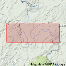
Type section: at Rough Creek crossing on Bend-San Saba Road, San Saba Co., central TX.
Source: US geologic names lexicon (USGS Bull. 1200, p. 483).
- Usage in publication:
-
- Brister Bluff lentil
- Modifications:
-
- Revised
- AAPG geologic province:
-
- Llano uplift
Summary:
Pg. 71-73. Brister Bluff lentil in Big Saline formation. Referred to as Brister Bluff lentil. Thickness at designated type locality 20 feet. Age is Early Pennsylvanian.
Source: US geologic names lexicon (USGS Bull. 1200, p. 483).
For more information, please contact Nancy Stamm, Geologic Names Committee Secretary.
Asterisk (*) indicates published by U.S. Geological Survey authors.
"No current usage" (†) implies that a name has been abandoned or has fallen into disuse. Former usage and, if known, replacement name given in parentheses ( ).
Slash (/) indicates name conflicts with nomenclatural guidelines (CSN, 1933; ACSN, 1961, 1970; NACSN, 1983, 2005, 2021). May be explained within brackets ([ ]).