The National Geologic Map Database is migrating to a new infrastructure. We apologize for any service disruptions during this process.
|
|---|


- Usage in publication:
-
- Brisbois formation
- Modifications:
-
- Areal extent
- AAPG geologic province:
-
- Snake River basin
Summary:
Upper Triassic sequence includes Begg, Brisbois, and Rail Cabin formations. Thickness of sequence, which is overlain by Lower Jurassic Graylock formation (new), is nearly 15,000 feet.
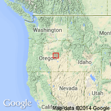
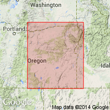
Type locality and derivation of name not stated by author. Report discusses Izee area, Grant Co., central OR.
Source: US geologic names lexicon (USGS Bull. 1200, p. 482).
- Usage in publication:
-
- Brisbois Formation
- Modifications:
-
- Overview
Summary:
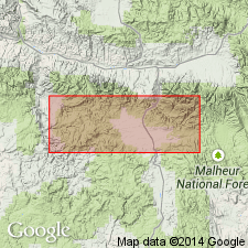
Pg. 6. Brisbois Formation. Originally defined by Dickinson and Vigrass (1965) after exposures along South Fork of John Day River between mouths of Morgan and Dry Soda Creeks (a distance of three miles). Is fairly widespread in central Suplee area of central Oregon surrounding type locality. Consists of 5,000 feet of black, gray, and green mudstone intercalated with minor amounts of sandy limestone and limy sandstone. It differs from the Begg Formation in its greater abundance of fine-grained clastics and limy composition of the more resistant intercalated interbeds. The contact between the two units in the field is arbitrary, but is generally placed where a decrease in abundance of resistant interbeds of variable composition (Begg Formation) is noticeable. Limestone consists of gray, calcareous interbeds of bioclastic debris which includes fragments brachiopods, pelecypods, gastropods, and crinoids. Locally, bioclastic debris grades laterally into relatively undisturbed reefoid limestones. Middle 2,000 feet of unit contains a total of 600 feet of interbedded spilites and sills of felsic keratophyre and granophyre. Brisbois is conformable over the Begg and unconformable under younger Mesozoic units. Age is latest Karnian (TROPITES SUBBULLATUS zone).
See also Dickinson, W.R., and Vigrass, L.W., 1965, "Geology of the Suplee-Izee area, Cook, Grant, and Harney Counties, Oregon," Oregon Dept. Geol. and Min. Ind. Bull., no. 58, 109 p., geol. map (scale 1:42,000).
Source: Publication.
- Usage in publication:
-
- Brisbois Member*
- Modifications:
-
- Revised
- Adopted
- AAPG geologic province:
-
- Blue Mountains province
Summary:
Brisbois Member of Vester Formation. Brisbois Formation of Dickinson and Vigrass (1965) adopted by the USGS as upper of two members of Vester Formation. Present in northeastern Oregon. Conformably overlies Begg Member (also newly adopted) of Vester; unconformably underlies Rail Cabin Argillite (also newly adopted). Age is Late Triassic (Carnian).
Source: Changes in stratigraphic nomenclature, 1977 (USGS Bull. 1457-A, p. A13).
For more information, please contact Nancy Stamm, Geologic Names Committee Secretary.
Asterisk (*) indicates published by U.S. Geological Survey authors.
"No current usage" (†) implies that a name has been abandoned or has fallen into disuse. Former usage and, if known, replacement name given in parentheses ( ).
Slash (/) indicates name conflicts with nomenclatural guidelines (CSN, 1933; ACSN, 1961, 1970; NACSN, 1983, 2005, 2021). May be explained within brackets ([ ]).