The National Geologic Map Database is migrating to a new infrastructure. We apologize for any service disruptions during this process.
|
|---|


- Usage in publication:
-
- Brindle Pup andesite*
- Modifications:
-
- Original reference
- Dominant lithology:
-
- Basalt
- Andesite
- AAPG geologic province:
-
- Southwestern Basin-and-Range region
Summary:
p. 14, pl. 1. Dark-gray rock which weathers to light-brown surfaces on which cream-colored plagioclase phenocrysts are conspicuous. Groundmass aphanitic to very finely crystalline. Vesicles and quartz amygdules present, increasing in abundance near flow tops. Intercalated Buzzard and Deception rhyolitic flows and basaltic flows similar to Shea basalt. Basaltic flows highly vesicular greenish-black lava containing sparse plagioclase phenocrysts in finely crystalline groundmass. Thickness ranges from about 2,500 feet in widest outcrop to a wedge line. Underlies Deception rhyolite; overlies Buzzard rhyolite (new). Age is Precambrian (Yavapai).
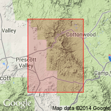
Named and defined from Brindle Pup Gulch, Jerome area, Yavapai Co., central AZ, where it is well exposed. Occurs as thick lense to south of Mingus Mountain.
Source: US geologic names lexicon (USGS Bull. 1200, p. 481).
For more information, please contact Nancy Stamm, Geologic Names Committee Secretary.
Asterisk (*) indicates published by U.S. Geological Survey authors.
"No current usage" (†) implies that a name has been abandoned or has fallen into disuse. Former usage and, if known, replacement name given in parentheses ( ).
Slash (/) indicates name conflicts with nomenclatural guidelines (CSN, 1933; ACSN, 1961, 1970; NACSN, 1983, 2005, 2021). May be explained within brackets ([ ]).