

- Usage in publication:
-
- Bridle formation*
- Modifications:
-
- Original reference
- Dominant lithology:
-
- Andesite
- Basalt
- Tuff
- Schist
- AAPG geologic province:
-
- Southwestern Basin-and-Range region
Summary:
Pg. 7-10, pl. 3. Bridle formation. Metamorphosed series of amygdaloidal and massive flows of andesite and basalt and intercalated sedimentary rocks and rhyolitic tuff. Includes belt of chlorite-biotite schist separately mapped as "spotted schist" (pl. 3). Sedimentary rocks were predominantly deposited in water; they have become schistose rocks in which chlorite and sericite are chief foliated minerals. Thickness 3,000 feet in mapped area; greater thickness exposed in unmapped area south of Bridle Creek. Oldest formation of Yavapai series; underlies Butte Falls tuff (new). Intruded by Dick rhyolite and Lawler Peak granite (both new). Mass of King Peak rhyolite (new) exposed west of Niagara Creek is essentially concordont with southwestern belt of Bridle formation, but evidence proves that rhyolite is intrusive. Age is Precambrian (Yavapai).
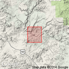
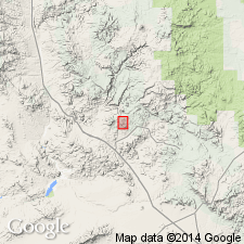
Crops out in two belts in southern part of Bagdad area, Yavapai Co., west-central AZ. Named from Bridle Creek, [south of Bagdad, in T. 14 N., R. 9 W., Bagdad quadrangle, Yavapai Co., west-central AZ].
Source: US geologic names lexicon (USGS Bull. 1200, p. 476).
- Usage in publication:
-
- Bridle Formation
- Modifications:
-
- Revised
- Redescribed
- Dominant lithology:
-
- Volcanics
- Tuff
- Agglomerate
- AAPG geologic province:
-
- Southwestern Basin-and-Range region
Summary:
Upper contact now revised placing Dick Rhyolite as the conformable overlying unit. Upper part of Bridle reveals minor vesicular tuffs and agglomerates in the northern part of the mapped area, and intermediate composition enigmatic (clastic?) and felsic volcanic rocks in the southern part of the area south of Old Dick Mine, western Yavapai Co, AZ in Southwestern Basin-and-Range region. Associated with a layered gabbro-anorthosite body, intrusions of sill-like alaskite and granophyre bodies, and King Peak Rhyolite. Geologic map provided, extending coverage just south and west of map by Anderson, Scholz, and Strobell, Jr., (1955). Widespread hydrothermal alternation noted, including albitization and epidotization and locally, chloritization in the vicinity of Old Dick and Bruce sulfide deposits. Could be younger than volcanic rocks of the Yavapai Series in the Jerome-Prescott area to the east. Is of Early Proterozoic age.
Source: GNU records (USGS DDS-6; Denver GNULEX).
For more information, please contact Nancy Stamm, Geologic Names Committee Secretary.
Asterisk (*) indicates published by U.S. Geological Survey authors.
"No current usage" (†) implies that a name has been abandoned or has fallen into disuse. Former usage and, if known, replacement name given in parentheses ( ).
Slash (/) indicates name conflicts with nomenclatural guidelines (CSN, 1933; ACSN, 1961, 1970; NACSN, 1983, 2005, 2021). May be explained within brackets ([ ]).