- Usage in publication:
-
- Briar Hill (No. 5A) coal member
- Modifications:
-
- Overview
- Dominant lithology:
-
- Coal
- AAPG geologic province:
-
- Illinois basin
Summary:
Pg. 34, 47 (table 1), pl. 1. Briar Hill (No. 5A) coal member of Carbondale formation of Kewanee group (new). Occurs above St. David limestone member and below Vermilionville sandstone member. Coal named by L.C. Glenn (Kentucky Geol. Survey Bull., no. 17, 75 p., 1912). Age is Pennsylvanian. Report presents new rock-stratigraphic classification of Pennsylvanian strata in Illinois. Cyclical classification retained but is entirely independent of rock-stratigraphic classification.
[GNU remark (Feb. 27, 1995, USGS DDS-6; Reston GNULEX): Referred to as Briar Hill (No. 5A) Coal Member in almost all subsequent reports.]
Source: Publication; US geologic names lexicon (USGS Bull. 1200, p. 472).

- Usage in publication:
-
- Briar Hill (No. 5A) Coal Member
- Modifications:
-
- Overview
- AAPG geologic province:
-
- Illinois basin
Summary:
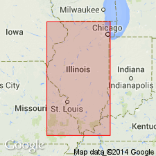
Pg. 189, 191. Briar Hill (No. 5A) Coal Member of Carbondale Formation (Glenn, 1912, Kentucky Geol. Survey Bull., no. 17, p. 38) is named from Briar Hill, a hill near Dekoven Station, Union County, Kentucky. The name was adopted in Illinois (Cady, 1919, Illinois Geol. Survey Mining Inv. Bull., no. 19, p. 20; 1926, Illinois Acad. Sci. Trans., v. 19, p. 255), and a locality in Saline County (T. 9 S., R. 7 E.) was designated as representative for Illinois (Wanless, 1956, Illinois Geol. Survey Circ., no. 217, p. 10). In Kentucky, this coal is now referred to as the No. 10 coal. In Illinois, the Briar Hill is fairly continuous in southeastern Illinois and has been recognized as far as Clark County on the northeast and Mt. Vernon on the northwest. It is generally thin and has been mined only on a small scale in the state. The coal is overlain by a dark gray to black shale that is fissile in places and is seldom over 2 feet thick. It is underlain by a hard silty underclay. It extends into southwestern Indiana.
Source: Publication.
For more information, please contact Nancy Stamm, Geologic Names Committee Secretary.
Asterisk (*) indicates published by U.S. Geological Survey authors.
"No current usage" (†) implies that a name has been abandoned or has fallen into disuse. Former usage and, if known, replacement name given in parentheses ( ).
Slash (/) indicates name conflicts with nomenclatural guidelines (CSN, 1933; ACSN, 1961, 1970; NACSN, 1983, 2005, 2021). May be explained within brackets ([ ]).

