

- Usage in publication:
-
- Brian Head formation*
- Modifications:
-
- Original reference
- Dominant lithology:
-
- Silts
- Limestone
- Sandstone
- Conglomerate
- Ash
- AAPG geologic province:
-
- Great Basin province
Summary:
Pg. 591-597, 599, 601, 602. Brian Head Formation. Series of white. calcareous, and siliceous shale-like beds overlain by gray igneous agglomerates which in places form surface of plateaus and in other places extend upward to capping sheets of black lava. Thickness about 80 feet in Antimony Canyon; 520 feet in Horse Creek Canyon; 968 feet in North Branch of Limekiln Gulch. Overlies Wasatch formation. Age is Miocene(?).
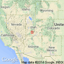
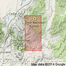
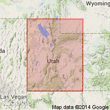
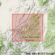
Named from Brian Head, a prominent projection on western rim of Markagunt Plateau near Cedar Breaks National Monument, [in SW/4 sec. 12, R. 9 W., T. 36 S., Lat. 37 deg. 40 min. 52 sec. N., Long. 112 deg. 49 min. 53 sec. W., Brian Head 7.5-min quadrangle, Iron Co., Dixie National Forest], southwestern UT. [Additional locality information from USGS GNIS database, USGS historical topographic map collection TopoView; accessed December 4, 2012.]
Source: US geologic names lexicon (USGS Bull. 1200, p. 471).
- Usage in publication:
-
- Brian Head formation*
- Modifications:
-
- Original reference
- Dominant lithology:
-
- Ash
- Breccia
- Lava
- AAPG geologic province:
-
- Great Basin province
Summary:
Pg. 105-110. Brian Head formation. At type locality, consists mostly of volcanic ash with subordinate sandstone; upper part includes 8 to 40 feet of breccia. Total thickness 489 to 539 feet. Overlies Wasatch formation; unconformably underlies unnamed rhyolitic lavas capping plateau. Age is considered Miocene(?).
Type locality stated to be Brian Head, a prominent projection on western rim of Markagunt Plateau near Cedar Breaks National Monument, [in SW/4 sec. 12, R. 9 W., T. 36 S., Lat. 37 deg. 40 min. 52 sec. N., Long. 112 deg. 49 min. 53 sec. W., Brian Head 7.5-min quadrangle, Iron Co., Dixie National Forest], southwestern UT. [Additional locality information from USGS GNIS database, USGS historical topographic map collection TopoView; accessed December 4, 2012.]
Source: Publication.
- Usage in publication:
-
- Brian Head Formation†
- Modifications:
-
- Abandoned
- AAPG geologic province:
-
- Great Basin province
- Paradox basin
Summary:
(See also Rowley and others, 1975, USGS Bull. 1405-B, p. B9.) †Brian Head Formation abandoned. Its rocks now included in part of Claron, Needles Range, Isom, Leach Canyon, and Mount Dutton (new) Formations.
[Adopted by the USGS (see Changes in stratigraphic nomenclature, 1976, USGS Bull. 1435-A, p. A12-A13).]
Source: Changes in stratigraphic nomenclature, 1976 (USGS Bull. 1435-A, p. A12-A13).
- Usage in publication:
-
- Brian Head Formation
- Modifications:
-
- Reinstated
- Revised
- Dominant lithology:
-
- Sandstone
- Conglomerate
- Volcaniclastics
- AAPG geologic province:
-
- Great Basin province
- Paradox basin
Summary:
Pg. 5-6. Brian Head Formation. Name is reinstated and restricted to strata between the Claron Formation and most commonly, the Needles Range Group or Isom Formation. Consists of (ascending) a basal conglomerate, non-tuffaceous red and gray sandstone, and tuffaceous sedimentary strata. Excludes the overlying "locally derived volcanic strata" that occurs beneath the Needles Range Group in some places. Thickness up to 350 feet (100+ m). Age is at least Oligocene, based on K-Ar age determinations of 29.1 +/-1.0 Ma and 30.4 +/-3.1 Ma (citing Mehnert and others, in press) and may be as old as Eocene, based on vertebrates identified by J. Eaton (oral commun., 1992).
Source: Publication.
- Usage in publication:
-
- Brian Head Formation*
- Modifications:
-
- Principal reference
- Revised
- Age modified
- Dominant lithology:
-
- Volcaniclastics
- Sandstone
- Conglomerate
- Volcanics
- AAPG geologic province:
-
- Great Basin province
- Paradox basin
Summary:
Brian Head Formation. Subdivided into (descending): volcanic rocks unit, 0 to 40 m thick (present at Red Hills section, = "locally derived volcanic strata" excluded by Anderson, 1993); gray volcaniclastic unit; and sandstone and conglomerate unit. Total thickness at type about 220 m. Overlies Claron Formation. Underlies Isom Formation at type section and Needles Range Group at Red Hills section. Age is considered late Eocene(?) to middle Oligocene. Age of basal part of formation not well constrained. Feist and others (this vol., chap. B) suggest a maximum age of middle Eocene, based on charophytes, nonmarine mollusks, and palynomorphs from underlying Claron Formation; Eaton and Hutchison (GSA Rocky Mtn Section Abs. with Prog., 1995) suggest a late Eocene age based on preliminary studies of vertebrate fauna. Upper part of formation is middle Oligocene based on K-Ar ages between about 34 Ma and 32 Ma (citing Fleck and others, 1975, GSA Spec. Paper 160, p. 53-61; H.H. Mehnert, written commun., Jan. 1992; L.W. Snee, written commun., Feb. 1994).
Type section: Brian Head (peak), in contiguous quarters of secs. 11, 12, 13, and 14, T. 36 S., R. 9 W., Brian Head 7.5-min quadrangle, Iron Co., southwestern UT.
Reference section: Red Hills section, in NW/4 and NE/4 of SE/4 sec. 8, T. 33 S., R. 9 W., Parowan Gap 7.5-min quadrangle, Iron Co., southwestern UT.
Source: Publication.
For more information, please contact Nancy Stamm, Geologic Names Committee Secretary.
Asterisk (*) indicates published by U.S. Geological Survey authors.
"No current usage" (†) implies that a name has been abandoned or has fallen into disuse. Former usage and, if known, replacement name given in parentheses ( ).
Slash (/) indicates name conflicts with nomenclatural guidelines (CSN, 1933; ACSN, 1961, 1970; NACSN, 1983, 2005, 2021). May be explained within brackets ([ ]).