- Usage in publication:
-
- Brenna Formation
- Modifications:
-
- Original reference
- Dominant lithology:
-
- Clay
- AAPG geologic province:
-
- Sioux uplift
- Williston basin
Summary:
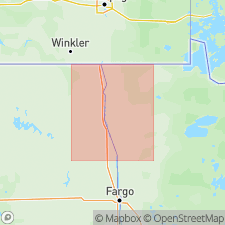
Pg. 5 (fig. 2), 19 (fig. 7) 21-22, 38-46 (measured sections). Brenna Formation. Dark-gray to black (wet), highly plastic, obscurely laminated to unbedded clay. Has a characteristic slick appearance. It is nearly impossible to break a sample of this material without it shearing to produce a slickensided surface. Clay is very weak, has high liquid limit and water content. Thickness in Grand Forks area (type area) about 40 to 50 feet; to the north in Pembina County, North Dakota, thickness up to about 150 feet. Overlies Falconer Formation (new); contact not observed but is believed to be conformable and gradational. Locally overlies Huot Formation (new). Underlies Sherack Formation (new); contact is erosional unconformity except in area north of Grand Forks, in central part of Red River valley, where it is conformable. Locally unconformably underlies Poplar River Formation (new). Exposed only in artificial excavations and a few river banks. Believed to extend as far north as Winnipeg, Manitoba. [Occurs along the Red River, in Traill, Grand Forks, Walsh, and Pembina Counties, North Dakota, and Polk, Marshall, and Kittson Counties, Minnesota.] Deposited in deep water in glacial Lake Agassiz. Age is considered late Pleistocene (latest Wisconsinan); deposited between about 13,000 to 11,000 yr B.P.; deposition possibly continued to about 10,000 yr B.P. north of type area.
Type section (subsurface): depth-interval 36 to 84 ft, University of North Dakota-Grand Forks, Witmer Hall, Boring No. 3, in SE/4 SE/4 SE/4 sec. 5, T. 151 N., R. 50 W., Grand Forks 7.5-min quadrangle, Grand Forks Co., eastern ND.
Reference sections (subsurface), North Dakota State Water Commission (NDSWC) Testholes 2430, 2431, 2433, 2609, Grand Forks area, Grand Forks 7.5-min quadrangle, Grand Forks Co., eastern ND [localities are taken from index map (fig. 7) and measured section descriptions (p. 38-46); some differ from what is given in text]:
(1) depth-interval 37 to 74 ft, No. 2430, in NE/4 SE/4 SE/4 sec. 29, T. 152 N., R. 50 W.
(2) depth-interval 40 to 68 ft, No. 2431, in NW/4 NW/4 NW/4 sec. 22, T. 151 N., R. 50 W.
(3) depth-interval 36 to 76 ft, No. 2433, in SE/4 NE/4 SE/4 sec. 6, T. 151 N., R. 50 W.
(4) depth-interval 30 to 69 ft, No. 2609, in SE/4 SE/4 SE/4 sec. 36, T. 152 N., R. 51 W.
Reference section (subsurface): depth-interval 46 to 112 ft, US Army Corps of Engineers Oslo Dike Boring No. 68-12M, in NE/4 SE/4 SE/4 sec. 31, T. 155 N., R. 50 W., Oslo area, Oslo 7.5-min quadrangle, Marshall Co., western MN.
Named from Brenna Twp., in Grand Forks area, Grand Forks 7.5-min quadrangle, Grand Forks Co., eastern ND.
Source: Publication.
For more information, please contact Nancy Stamm, Geologic Names Committee Secretary.
Asterisk (*) indicates published by U.S. Geological Survey authors.
"No current usage" (†) implies that a name has been abandoned or has fallen into disuse. Former usage and, if known, replacement name given in parentheses ( ).
Slash (/) indicates name conflicts with nomenclatural guidelines (CSN, 1933; ACSN, 1961, 1970; NACSN, 1983, 2005, 2021). May be explained within brackets ([ ]).

