

- Usage in publication:
-
- Brasstown schist*
- Modifications:
-
- Named
- Dominant lithology:
-
- Schist
- Slate
- AAPG geologic province:
-
- Piedmont-Blue Ridge province
Summary:
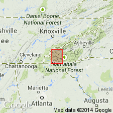
Brasstown schist named along Brasstown Creek, Clay Co., western NC. Extends into eastern TN and north-central GA. Greater part consists of banded ottrelite schist, at base of which is a variable thickness of banded slate with little or no ottrelite. This lower member is most developed south of Valley River, and relation of the two members to each other is well seen between Brasstown and Hayesville. A few mi north of Brasstown the ottrelite-bearing rocks are much less conspicuous and banded slates occupy a large area. The strata there are less folded and metamorphism is less. On north side of Valley River basin practically all of formation contains ottrelite. Eastward toward Nantahala River the ottrelite diminishes, and disappears in neighborhood of Nantahala. All schists and slates of the formation are dark colored and vary from dark blue or bluish black to dark gray. They are nearly always marked by fine banding of light-gray and dark colors. The light-gray layers are slightly siliceous and occasionally grade through sandy slate into seams of light-gray sandstone. Thickness estimated at 1,200 to 1,500 ft. Underlies Valleytown formation and overlies Tusquitee quartzite.
Source: GNU records (USGS DDS-6; Reston GNULEX).
- Usage in publication:
-
- Brasstown Formation
- Modifications:
-
- Revised
- Overview
- AAPG geologic province:
-
- Piedmont-Blue Ridge province
Summary:
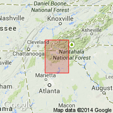
Name Hiwassee River Group is here proposed for strata in the Murphy belt overlying the Great Smoky Group and underlying the Mineral Bluff Group (rank raised). Unit encompasses (ascending) the Nantahala Formation, the Brasstown Formation, and the Murphy Marble. Tusquitee Quartzite and Valleytown Formation are here abandoned. Term Murphy group also abandoned. Base of the Brasstown is defined as being above the uppermost meta-subarkose unit of the Nantahala Formation. Brasstown is composed of slates, schists, and thin meta-subarkoses. Upper Brasstown of current usage was Valleytown of Keith (1907). Brasstown and overlying Murphy Marble are commonly interbedded for 2 to 3 m across gradational contact. Excellent exposures along both sides of Hiwassee River west of Murphy are here designated a reference section.
Source: GNU records (USGS DDS-6; Reston GNULEX).
For more information, please contact Nancy Stamm, Geologic Names Committee Secretary.
Asterisk (*) indicates published by U.S. Geological Survey authors.
"No current usage" (†) implies that a name has been abandoned or has fallen into disuse. Former usage and, if known, replacement name given in parentheses ( ).
Slash (/) indicates name conflicts with nomenclatural guidelines (CSN, 1933; ACSN, 1961, 1970; NACSN, 1983, 2005, 2021). May be explained within brackets ([ ]).