

- Usage in publication:
-
- Branch Canyon formation
- Modifications:
-
- Original reference
- Biostratigraphic dating
- Dominant lithology:
-
- Sandstone
- AAPG geologic province:
-
- Coastal basins
- Santa Maria basin
- Ventura basin
Summary:
Pg. 2974 (fig. 1), 2991-2993. Branch Canyon formation. On south side of Cuyuma Valley and on northeast flank of Caliente Range, Monterey shale grades laterally eastward into marine sandstone which in turn grades eastward into continental Caliente formation; this marine sandstone is herein designated Branch Canyon formation; as transitional facies includes minor fingers of marine shales and continental claystones and sandstones. At type section, comprises units mapped by Eaton and others, 1941 (AAPG Bull., v. 25, no. 2) as (descending) lower "Neroly," "Clerbo," "Briones," "Temblor," and "Vaqueros"; section is 3,000 feet thick. Southeast of type locality, between Branch and Salisbury Canyons, formation is divisible into two units separated by a 750-foot interval of Monterey shale that contains Relizian microfauna; lower unit (mapped as Vaqueros by English, 1916, USGS Bull. 621-M) consists of about 1,200 feet of medium- to coarse-grained thick-bedded sandstone containing a TURRITELLA OCOYANA fauna and lies directly on Cretaceous sandstone; upper unit consists of about 1,400 feet of medium-grained sandstone that conformably underlies basal shale of Santa Margarita formation; on northeast flank of Caliente Range, formation consists of about 1,500 feet of sandstone that contains three amygdaloidal basalt flows up to 50 feet thick (triple basalt flows of Eaton) which serve as key beds. Formation at its type locality is Relizian and possibly Luisian (middle Miocene), and upper 100 feet may be as young as upper Miocene (Eaton's lower "Neroly"); [see also Eaton and others (1941) for megafauna list]. Preoccupied term Bitter Creek has been used for unit herein designated as Branch Canyon.
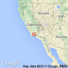
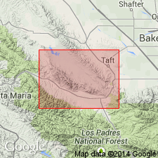
Type section: measured in sec. 2, T. 9 N., T. 27 W., Branch Canyon, 3 mi south of New Cuyama, New Cuyama 7.5-min quadrangle, Santa Barbara Co., CA.
Source: US geologic names lexicon (USGS Bull. 1200, p. 452-453); supplemental information from GNU records (USGS DDS-6; Menlo GNULEX).
- Usage in publication:
-
- Branch Canyon Sandstone*
- Modifications:
-
- Biostratigraphic dating
- Revised
- Redescribed
- AAPG geologic province:
-
- Transverse Ranges province
Summary:
Branch Canyon Formation of Hill and others (1958) is redescribed as Branch Canyon Sandstone. In Sierra Madre Mountains and Caliente Range, grades laterally westward into the Monterey Shale. South of Cuyama Valley, is 3,200 feet thick; lower 2,100 feet contains "Temblor Stage" (middle Miocene) fossils, upper 1,100 feet contains "Santa Margarita Stage" (late Miocene) [provincial age] fossils. Further east intertongues with and is overlain by nonmarine sediments. In Caliente Range, is up to 3,000 feet thick; contains "Temblor Stage" (middle Miocene) fossils only. Southwestward, intertongues with Saltos Shale Member of Monterey; conformably underlies Santa Margarita Formation. To the southeast, intertongues with and underlies the Caliente Formation. Occurrences in wells on northeastern flank of Caliente Range suggest unit is continuous under southwest Carrizo Plain to and beyond Cholame. Is a strandline deposit between the Monterey offshore and the terrestrial Caliente Formation. Age is middle and late Miocene. Branch Canyon Sandstone adopted by the USGS.
Source: Modified from GNU records (USGS DDS-6; Menlo GNULEX); Changes in stratigraphic nomenclature, 1973 (USGS Bull. 1395-A, p. A6-A7).
- Usage in publication:
-
- Branch Canyon Formation
- Modifications:
-
- Revised
- AAPG geologic province:
-
- Transverse Ranges province
Summary:
More detailed work has shown that Hill and others' (1958) type section of Branch Canyon Formation contains three formational units and ranges in age from early to late Miocene: (1) lower light-brown, silty shale, belonging to either the Vaqueros or Monterey Formation, (2) middle, light-gray, structureless sandstone newly named Hurricane Deck Formation by Thomas and others (1988, this volume), and (3) the "true" Branch Canyon Formation as recognized in this report. At type section unit conformably underlies Santa Margarita Formation. North of Sierra Madre in eastern Caliente Range, three basalt flows yielded isotopic ages of 16.5 +/-1.3 to 14.6 +/-0.6 Ma. Here unit unconformably underlies Caliente Formation. Measured sections and discussion of environments and origin of unconformity included in report.
Source: GNU records (USGS DDS-6; Menlo GNULEX).
- Usage in publication:
-
- Branch Canyon Sandstone*
- Modifications:
-
- Age modified
- AAPG geologic province:
-
- Transverse Ranges province
Summary:
Age of the Branch Canyon Sandstone in the area of the report (southeastern Caliente Range) is early and middle Miocene. Overall age of unit is thus revised from middle and late Miocene to: early, middle, and late Miocene.
Source: GNU records (USGS DDS-6; Menlo GNULEX).
For more information, please contact Nancy Stamm, Geologic Names Committee Secretary.
Asterisk (*) indicates published by U.S. Geological Survey authors.
"No current usage" (†) implies that a name has been abandoned or has fallen into disuse. Former usage and, if known, replacement name given in parentheses ( ).
Slash (/) indicates name conflicts with nomenclatural guidelines (CSN, 1933; ACSN, 1961, 1970; NACSN, 1983, 2005, 2021). May be explained within brackets ([ ]).