

- Usage in publication:
-
- Brainard shale*
- Modifications:
-
- Original reference
- Dominant lithology:
-
- Shale
- AAPG geologic province:
-
- Iowa shelf
Summary:
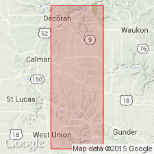
Pg. 60, 97. Brainard shale. Blue and bluish gray shales, with some intimately associated limestone beds at top and bottom. Thickness 120+/- feet. Forms top formation of Maquoketa stage [group]. Overlies Fort Atkinson limestone of Maquoketa stage and is succeeded by Hopkinton limestone of Niagara age. Age is Late Ordovician.
Named from exposures near Brainard, Fayette Co., northeastern IA.
Source: US geologic names lexicon (USGS Bull. 896, p. 249-250).
- Usage in publication:
-
- Brainard shale*
- Modifications:
-
- Areal extent
- AAPG geologic province:
-
- Iowa shelf
Summary:
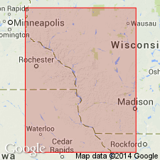
Pg. 71. Brainard shale at Savannah, Illinois, is unconformably overlain by Burroughs dolomite.
Source: US geologic names lexicon (USGS Bull. 896, p. 249-250).
- Usage in publication:
-
- Brainard member*
- Modifications:
-
- Revised
- AAPG geologic province:
-
- Iowa shelf
Summary:
Chart 2 (column 59). Shown on correlation chart as Brainard member of Maquoketa formation. Underlies Neda shale member; Overlies Fort Atkinson limestone member.
Source: US geologic names lexicon (USGS Bull. 1200, p. 451).
- Usage in publication:
-
- Brainard member*
- Modifications:
-
- Revised
- AAPG geologic province:
-
- Iowa shelf
Summary:
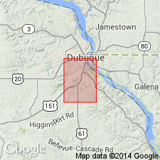
Brainard member of Maquoketa shale. Described in Dubuque South quadrangle, Iowa-Illinois, where its rank is reduced to member status in Maquoketa shale. Consists of grayish-green and pale-blue soft dolomitic shale. Thickness as much as 135 feet. Underlies Neda member; overlies brown shaly unit in lower part of the Maquoketa.
Source: US geologic names lexicon (USGS Bull. 1200, p. 451).
For more information, please contact Nancy Stamm, Geologic Names Committee Secretary.
Asterisk (*) indicates published by U.S. Geological Survey authors.
"No current usage" (†) implies that a name has been abandoned or has fallen into disuse. Former usage and, if known, replacement name given in parentheses ( ).
Slash (/) indicates name conflicts with nomenclatural guidelines (CSN, 1933; ACSN, 1961, 1970; NACSN, 1983, 2005, 2021). May be explained within brackets ([ ]).