

- Usage in publication:
-
- Brady Canyon Member
- Modifications:
-
- Original reference
- AAPG geologic province:
-
- Plateau sedimentary province
Summary:
Pg. 702. Brady Canyon Member of Toroweap Formation. Middle member of Toroweap. Overlies Seligman Member and underlies Woods Ranch Member (both new). The three members represent transgression, maximum extension, and regression of Toroweap sea, respectively. Age is Early Permian (Leonardian).
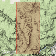
Study area: Whitmore area, Mohave Co., northwestern AZ.
Source: US geologic names lexicon (USGS Bull. 1350, p. 88).
- Usage in publication:
-
- Brady Canyon Limestone
- Modifications:
-
- Revised
- AAPG geologic province:
-
- Paradox basin
Summary:
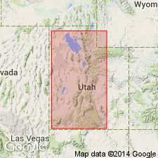
Dolomite unconformably above the White Rim Sandstone in UT in the Capitol Reef area and unconformably above the Cedar Mesa Sandstone in the San Rafael area formerly assigned to the Kaibab Limestone is removed from the Kaibab and reassigned to the newly named Black Box Dolomite. Term Kaibab is restricted geographically to two areas of southwest UT discussed in this report--Marysvale and Beaver Dam. Kaibab considered --at Marysvale to be of group rank in this report and is divided into: 1) Toroweap Formation (basal unit) and Fossil Mountain Limestone (top); and 2) in the Beaver Dam Mountains --Seligman (base) and Brady Canyon Limestones, Woods Ranch Formation, Kaibab Limestone ["when a unit is divided into two or more of the same rank as the original, the original name should not be used for any of the divisions." NASC, 1983, art. 19g.], and Plympton Formation (top). Black Box shown as equivalent to Kaibab of the Beaver Dam Mountains. Cross section. Permian age. [Intent or reason to modify rank of Kaibab not stated.]
Source: GNU records (USGS DDS-6; Denver GNULEX).
- Usage in publication:
-
- Brady Canyon Member
- Modifications:
-
- Overview
- AAPG geologic province:
-
- Plateau sedimentary province
Summary:
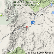
First reported occurrence of sponge HAPLISTION ARMSTRONGI reported in the upper 1-2 m in a gray lime mudstone of the Brady Canyon Member of Permian Toroweap Formation in exposures in roadcut at mile 26, Interstate 15, sec 2, T41N, R13W, Mohave Co, AZ in the Plateau sedimentary province. Brady Canyon is the middle of three members of the Toroweap; it overlies Seligman Member and underlies Woods Ranch Member. Sponges are associated with a normal marine fauna of crinoid columnals, large productid brachiopods, fenestrate bryozoans, and occasional rugose corals. The bryozoans appear to be in place, but all the other fossils were probably transported.
Source: GNU records (USGS DDS-6; Denver GNULEX).
- Usage in publication:
-
- Brady Canyon Member*
- Modifications:
-
- Principal reference
- Dominant lithology:
-
- Limestone
- AAPG geologic province:
-
- Plateau sedimentary province
- Basin-and-Range province
Summary:
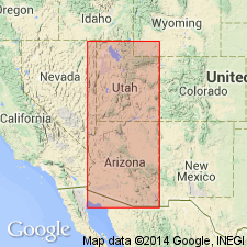
Named as middle cliff-forming member of Toroweap Formation for Brady Canyon, Mohave Co, AZ, Plateau sedimentary province. Was: 1) part of Darton's (1910) Kaibab Limestone; 2) McKee's (1938) beta member of Toroweap; 3) named by Sorauf (1962) in a thesis. Used in publications since 1969. Type locality designated in Brady Canyon about 12.8 mi north of Colorado River on east side Toroweap Valley. Consists of gray, fossiliferous marine limestone that varies from thin to thick bedded, ledge and cliff forming, 218.5 ft thick at type where it overlies Seligman Member (revised) and underlies Woods Ranch Member (named), both of Toroweap. Blue chert is basal bed at type. Designated reference section extends from southwest corner sec 12, T33N, R9W to top of Hurricane Cliffs where member consists of limestone that varies from tan, brown, gray to black, coarse-, fine- to medium-grained, thin-bedded to massive, ledge- and cliff-forming, silty, sucrosic, or vugular, tan- to gray-weathering limestone with some gray and black chert as lenses and nodules 191.6 ft thick. Fossils: crinoids, bryozoa, echinoderms, dictyoclostids. Maximum thickness 305 ft at Pakoon ridge. East limit is line that runs north-south from Page to Prescott in Yavapai Co, Basin-and-Range province. East of that line Toroweap is undivided. Early Permian, Leonardian, age. Nomenclature chart. Has abundant marine fossils.
Source: GNU records (USGS DDS-6; Denver GNULEX).

- Usage in publication:
-
- Brady Canyon Member*
- Modifications:
-
- Areal extent
- AAPG geologic province:
-
- Great Basin province
Summary:
Mapped as a member of Toroweap Formation in east-central Lincoln Co., NV in the Great Basin province where it overlies Seligman Member (not mapped) of Toroweap and underlies Woods Ranch Member of Toroweap. Consists in map area of about 90 m of gray, thick-bedded to massive, ledge-forming cherty limestone and dolomitic limestone, and brown chert as bedded nodules or isolated spherical bodies. Brachiopod and crinoid fossils of Early Permian, Leonardian age.
Source: GNU records (USGS DDS-6; Denver GNULEX).
For more information, please contact Nancy Stamm, Geologic Names Committee Secretary.
Asterisk (*) indicates published by U.S. Geological Survey authors.
"No current usage" (†) implies that a name has been abandoned or has fallen into disuse. Former usage and, if known, replacement name given in parentheses ( ).
Slash (/) indicates name conflicts with nomenclatural guidelines (CSN, 1933; ACSN, 1961, 1970; NACSN, 1983, 2005, 2021). May be explained within brackets ([ ]).