The National Geologic Map Database is migrating to a new infrastructure. We apologize for any service disruptions during this process.
|
|---|


- Usage in publication:
-
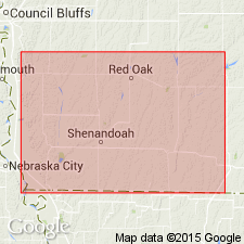
- Braddyville limestones
- Modifications:
-
- Original reference
- Dominant lithology:
-
- Limestone
- Shale
- AAPG geologic province:
-
- Forest City basin
Summary:
Pg. 617, 618, 623, 629, 632. Braddyville limestones. Limestones and shales, 50 feet thick, forming basal part of Atchison shales. Underlies City Bluffs [Scranton] shales and overlies Forbes [Deer Creek] limestone. Included in Missouri stage.
Named from exposures at Braddyville, Page Co., southwestern IA.
Source: US geologic names lexicon (USGS Bull. 896, p. 246).
- Usage in publication:
-
- Braddyville formation
- Modifications:
-
- Revised
- AAPG geologic province:
-
- Nemaha anticline
- Salina basin
Summary:
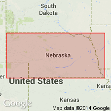
Braddyville formation. In southeastern Nebraska, includes the following members (ascending): unnamed shale, 6 to 10 feet; Meadow limestone (new), 2 feet 7 inches to 4 feet; unnamed shale, 2 feet 8 inches to 6 feet; an undetermined interval of unknown thickness; Union limestone (new), 3 feet 8 inches to 4 feet; unnamed shale; Louisville limestone (new), 10 to 12 feet; unnamed shale 6.5 to 10 feet; South Bend limestone (new), 8 to 9 feet; unnamed shale, 16 to 18 feet; and Ashland limestone (new), 12 feet. Total thickness 90+ feet. Overlies Forbes limestone (Deer Creek); underlies City Bluffs shales (Scranton). Age is Pennsylvanian. Report includes measured sections, cross sections.
Source: GNC KS-NE Pennsylvanian Corr. Chart, sheet 1, Oct. 1936; supplemental information from GNU records (USGS DDS-6; Denver GNULEX).

- Usage in publication:
-
- Braddyville limestone†
- Modifications:
-
- Abandoned
Summary:
Pg. 191, 195. †Braddyville limestone of Missouri and Iowa. Includes Topeka limestone and Calhoun shale of Shawnee group.
Source: US geologic names lexicon (USGS Bull. 896, p. 246); GNC KS-NE Pennsylvanian Corr. Chart, sheet 2.
For more information, please contact Nancy Stamm, Geologic Names Committee Secretary.
Asterisk (*) indicates published by U.S. Geological Survey authors.
"No current usage" (†) implies that a name has been abandoned or has fallen into disuse. Former usage and, if known, replacement name given in parentheses ( ).
Slash (/) indicates name conflicts with nomenclatural guidelines (CSN, 1933; ACSN, 1961, 1970; NACSN, 1983, 2005, 2021). May be explained within brackets ([ ]).