

- Usage in publication:
-
- Boyd Gap Formation
- Modifications:
-
- Named
- Dominant lithology:
-
- Phyllite
- Graywacke
- Slate
- AAPG geologic province:
-
- Appalachian basin
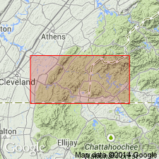
Summary:
Gray metasedimentary slate, phyllite, metagraywacke, and minor metaconglomerate here named Boyd Gap Formation of Great Smoky Group (Ocoee Supergroup). 2,450 m maximum thickness. Underlies Buck Bald Formation (first used); in contact with Farner Formation (first used), but stratigraphic relations are uncertain. Correlates in part with Hughes Gap Formation. Age is Late Proterozoic(?).
Source: GNU records (USGS DDS-6; Reston GNULEX).
- Usage in publication:
-
- Boyd Gap Formation*
- Modifications:
-
- Revised
- Areal extent
- AAPG geologic province:
-
- Appalachian basin
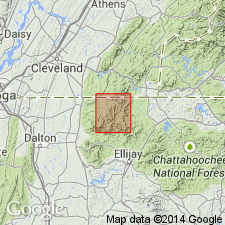
Summary:
In southeastern TN, southwestern NC, and by geographic extension, northwestern GA, Boyd Gap Formation of Wiener and Merschat (1978) is adopted as redefined in this paper and assigned to Great Smoky Group of Ocoee Supergroup as upper of two formations. Divided into informal lower and upper parts. Conformably overlies Panther Bluff Formation (named) of Great Smoky; underlies Buck Bald formation of Wiener and Merschat (1978). Age is Proterozoic Z.
Source: GNU records (USGS DDS-6; Reston GNULEX).
- Usage in publication:
-
- Boyd Gap Formation
- Modifications:
-
- Overview
- AAPG geologic province:
-
- Piedmont-Blue Ridge province
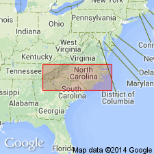
Summary:
Used as Late Proterozoic Boyd Gap Formation of Great Smoky Group of Ocoee Supergroup. Stratigraphic position is uncertain. In Cherokee Co., includes upper part of Buck Bald Formation.
Source: GNU records (USGS DDS-6; Reston GNULEX).
For more information, please contact Nancy Stamm, Geologic Names Committee Secretary.
Asterisk (*) indicates published by U.S. Geological Survey authors.
"No current usage" (†) implies that a name has been abandoned or has fallen into disuse. Former usage and, if known, replacement name given in parentheses ( ).
Slash (/) indicates name conflicts with nomenclatural guidelines (CSN, 1933; ACSN, 1961, 1970; NACSN, 1983, 2005, 2021). May be explained within brackets ([ ]).