- Usage in publication:
-
- Bow Quartzite*
- Modifications:
-
- Named
- Dominant lithology:
-
- Quartzite
- AAPG geologic province:
-
- Northern Rocky Mountain region
Summary:
Named the middle formation (of 5) of the Phantom Lake Metamorphic Suite, in the Medicine Bow Mountains. Considered to be a key unit in deciphering stratigraphy of the suite because it contains abundant large scale planar crossbeds and some oscillation ripple marks which indicate direction of stratigraphic top. Prominent crossbed mode is to southwest. Consists of quartzite (95 percent) which is white, very fine-grained to fine-grained, foliated, muscovitic arkose and subarkose, quartz-pebble conglomerates (local), biotite and hornblende schists and phyllites (local), and quartz-rich carbonates (local). Ranges from 200 to 580 m thick; averages about 350 m thick. Lower contact with Rock Mountain Conglomerate (new) of Phantom Lake Suite is sharp and conformable to gradational. Upper contact with Colberg Metavolcanics (new) of Phantom Lake Suite is unconformable. Considered to be a shallow marine, low-energy, river-fed embayment or estuarine deposit of Late Archean age. Source were granitic gneisses, metasedimentary and metavolcanic rocks. Report includes petrographic data, stratigraphic charts, geologic map.
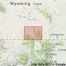
Type locality: exposures in the extreme northern Medicine Bow Mountains, in T. 19 N., R. 79 W., Carbon Co., WY, in the Northern Rocky Mountain region. Named from the Bow Ranger Station.
Source: Modified from GNU records (USGS DDS-6; Denver GNULEX).
For more information, please contact Nancy Stamm, Geologic Names Committee Secretary.
Asterisk (*) indicates published by U.S. Geological Survey authors.
"No current usage" (†) implies that a name has been abandoned or has fallen into disuse. Former usage and, if known, replacement name given in parentheses ( ).
Slash (/) indicates name conflicts with nomenclatural guidelines (CSN, 1933; ACSN, 1961, 1970; NACSN, 1983, 2005, 2021). May be explained within brackets ([ ]).

