The National Geologic Map Database is migrating to a new infrastructure. We apologize for any service disruptions during this process.
|
|---|


- Usage in publication:
-
- Bouse Formation*
- Modifications:
-
- Original reference
- Dominant lithology:
-
- Sand
- Silt
- Clay
- Claystone
- Gravel
- Marl
- AAPG geologic province:
-
- Basin-and-Range province
- Mojave basin
- Salton basin
Summary:
Bouse Formation. Consists of (1) a basal limestone, (2) interbedded clay, silt, and sand, and (3) a distinctive tufa that formed at or near water surface throughout time of deposition of other units. Principally a subsurface unit; thickness 767 feet at type. Exposed thickness 100 to 215 feet. Rests unconformably on Miocene(?) fanglomerate; underlies Holocene alluvium. Is a marine to brackish-water sequence, as indicated by fossils. Previously called "Cibola beds" (Wilson, 1962, Arizona Bur. Mines Bull., no. 171) and "lakebeds near Parker" (Ross, 1923, USGS Water-Supply Paper 498). Age is considered Pliocene. A thin tuff in the basal limestone yielded a K-Ar age of 3.02 +/-1.15 Ma (P.E. Damon, written commun., 1967); this age is considered a minimum because of partial devitrification of the glass.
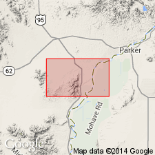
Type section (subsurface): depth-interval 114 to 881 ft, USGS test well LCRP 27, in NE/4 NE/4 NE/4 sec. 31, T. 7 N., R. 21 W., Gila and Salt River base line and meridian, Poston 7.5-min quadrangle, Yuma Co., Colorado River Indian Reservation, western AZ.
Reference sections (outcrop): (1) south of Bouse Wash and east of Colorado River floodplain, in SW/4 sec. 26 and SE/4 sec. 27, T. 8 N., R. 20 W., Gila and Salt River base line and meridian, [Parker SE and Moon Mtn NE 7.5-min quadrangles], Yuma Co., Colorado River Indian Reservation, western AZ; (2) basal limestone exposed southeast of Cibola, in secs. 9 and 16, T. 2 S., R. 23 W., Gila and Salt River base line and meridian, [Cibola and Picacho NW 7.5-min quadrangles], Yuma Co., western AZ.
Named from Bouse Wash, Yuma Co., western AZ. Bouse (rhymes with house).
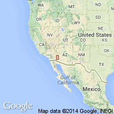
Notable exposures in Lower Colorado River area, Yuma Co., western AZ, and Imperial, Riverside, and San Bernadino Cos., southwestern CA.
Source: Publication.
- Usage in publication:
-
- Bouse Formation*
- Modifications:
-
- Areal extent
- AAPG geologic province:
-
- Salton basin
Summary:
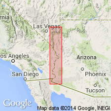
Geographically extended from southwestern AZ into Needles area of southeastern CA and southeastern NV. Unconformably overlies fanglomerate. Age given is Pliocene.
Source: GNU records (USGS DDS-6; Menlo GNULEX).
- Usage in publication:
-
- Bouse Formation*
- Modifications:
-
- Age modified
- Geochronologic dating
- AAPG geologic province:
-
- Basin-and-Range province
- Mojave basin
- Plateau sedimentary province
- Salton basin
Summary:
Age changed from Pliocene --to-- late Miocene and Pliocene. Tuff near base yielded K-Ar age of 5.47 +/-0.20 Ma. Fossils indicate an estuarine to marine environment.
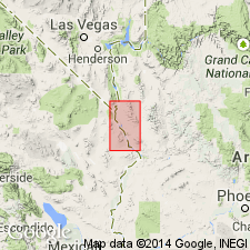
Occurs along both sides of the Colorado River in Arizona, Nevada, and California, a distance of about 275 km.
Source: Modified from GNU records (USGS DDS-6; Denver GNULEX).
- Usage in publication:
-
- Bouse Formation*
- Modifications:
-
- Areal extent
- AAPG geologic province:
-
- Mojave basin
- Salton basin
Summary:
Map shows extent in San Bernardino Co, CA in the Mojave basin and in Riverside Co, CA in the Salton basin. Described as including pale-red, tan, and green, calcareous, fossiliferous clay, silt, sand, and marl, moderately to poorly indurated and well bedded, 0-75 m thick, and underlying [not described at type section] porous concretionary calcium carbonate tufa, 0-1 m thick. Is younger than the fanglomerate of Osborne Wash (Pliocene and Miocene) and older than alluvium. Of Pliocene age.
Source: GNU records (USGS DDS-6; Denver GNULEX).
For more information, please contact Nancy Stamm, Geologic Names Committee Secretary.
Asterisk (*) indicates published by U.S. Geological Survey authors.
"No current usage" (†) implies that a name has been abandoned or has fallen into disuse. Former usage and, if known, replacement name given in parentheses ( ).
Slash (/) indicates name conflicts with nomenclatural guidelines (CSN, 1933; ACSN, 1961, 1970; NACSN, 1983, 2005, 2021). May be explained within brackets ([ ]).