

- Usage in publication:
-
- Boundary Ridge Member*
- Modifications:
-
- Named
- Dominant lithology:
-
- Limestone
- Siltstone
- AAPG geologic province:
-
- Yellowstone province
- Wasatch uplift
- Snake River basin
- Uinta uplift
- Green River basin
Summary:
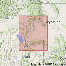
Named as one of seven members of Twin Creek Limestone for Boundary Ridge, east of type. Type section measured 1 mi southwest of Pegram, NW1/4 sec 12, T15S, R45E, Bear Lake Co, UT on Wasatch uplift. Formerly called member D of Twin Creek. Gradationally overlies Rich Member (new) of Twin Creek. Overlain sharply by Watton Canyon Member (new) of Twin Creek. Seven additional measured sections. Consists of yellow silty sandy and oolitic yellow limestone interbedded with soft red siltstone. Thickens west irregularly. Is 40 ft at Jackson Hole, Teton Co, WY, Yellowstone province to 187 ft at Willow Creek, Bonneville Co, ID, Snake River basin. Thickens west in UT from 30 ft at Lake Fork, Duchesne Co, UT, Uinta basin to 100 ft near Burr Fork, Utah Co and Devils Slide, Morgan Co on the Wasatch uplift. Also occurs north of Park City, Summit Co, UT on Uinta uplift and in southwest WY in Greater Green River basin. Proportion of limestone increases to west. Fragments of fossils identified. Entirely of Bathonian, Middle Jurassic age. Deposited in shallow retreating sea. Correlates with upper part of: Sawtooth Formation of western MT, Piper of central MT, Gypsum Spring of WY and SD, and Carmel Formation of central UT. Correlation chart. Cross sections.
Source: GNU records (USGS DDS-6; Denver GNULEX).

- Usage in publication:
-
- Boundary Ridge Member*
- Modifications:
-
- Age modified
- Overview
- AAPG geologic province:
-
- Yellowstone province
- Snake River basin
- Wasatch uplift
- Uinta basin
- Uinta uplift
Summary:
Is one (of seven) members of the Twin Creek Limestone. Overlies Rich Member of Twin Creek conformably throughout extent shown on correlation charts in Snake River basin, ID, Yellowstone province, WY, Wasatch uplift, Uinta basin, and Uinta uplift, UT. Correlation charts include information on thickness and lithology. Wedges out near Vernal, Uintah Co, UT, Uinta basin. Age modified from Bathonian to early Bathonian. Middle Jurassic age.
Source: GNU records (USGS DDS-6; Denver GNULEX).
For more information, please contact Nancy Stamm, Geologic Names Committee Secretary.
Asterisk (*) indicates published by U.S. Geological Survey authors.
"No current usage" (†) implies that a name has been abandoned or has fallen into disuse. Former usage and, if known, replacement name given in parentheses ( ).
Slash (/) indicates name conflicts with nomenclatural guidelines (CSN, 1933; ACSN, 1961, 1970; NACSN, 1983, 2005, 2021). May be explained within brackets ([ ]).