The National Geologic Map Database is migrating to a new infrastructure. We apologize for any service disruptions during this process.
|
|---|


- Usage in publication:
-
- Boundary granodiorite*
- Modifications:
-
- Named
- Dominant lithology:
-
- Granodiorite
- AAPG geologic province:
-
- Alaska Southeastern region
Summary:
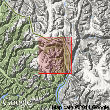
Named for exposures along both sides and at head of Boundary Glacier from about 1 mi above its foot, northeast corner of Salmon River area, southeastern AK. Also exposed on top of ridge north of eastern part of Texas Glacier. (It is not known whether unit forms apophysis from main Coast Range batholith, or if unit is separate stock.) Granodiorite is medium grained composed of white plagioclase with scattered grains of pink orthoclase, glassy quartz, biotite, hornblende and yellowish-brown titanite. Cut by dikes of green-gray and dark-gray sparsely porphyritic malachite and pink aplite. Shown on geologic map of Hyder district as Jurassic or Cretaceous in age.
Source: GNU records (USGS DDS-6; Menlo GNULEX).
- Usage in publication:
-
- Boundary Granodiorite*
- Modifications:
-
- Age modified
- Geochronologic dating
- AAPG geologic province:
-
- Alaska Southeastern region
Summary:
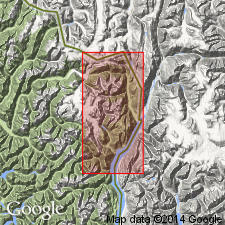
Maximum size is 65 sq km. Intrudes Hazelton(?) Group and Texas Creek Granodiorite. Age is Eocene based on K-Ar determinations on biotite of 50.9 +/-4 and 49.2 +/-2 Ma and on hornblende of 50.3 +/-2 and 48.7 +/-2 Ma. Samples were collected in both eastern and western parts of pluton.
Source: GNU records (USGS DDS-6; Menlo GNULEX).
For more information, please contact Nancy Stamm, Geologic Names Committee Secretary.
Asterisk (*) indicates published by U.S. Geological Survey authors.
"No current usage" (†) implies that a name has been abandoned or has fallen into disuse. Former usage and, if known, replacement name given in parentheses ( ).
Slash (/) indicates name conflicts with nomenclatural guidelines (CSN, 1933; ACSN, 1961, 1970; NACSN, 1983, 2005, 2021). May be explained within brackets ([ ]).