

- Usage in publication:
-
- Boulder Pass formation
- Modifications:
-
- First used
- Dominant lithology:
-
- Argillite
- Dolomite
- Limestone
- AAPG geologic province:
-
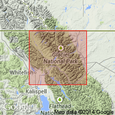
- Northern Rocky Mountain region
Summary:
First published use as a formation of the Belt series above the Siyeh formation. Intent to name not stated. No type locality designated nor source of geographic name stated. Divided into Hole-in-the-Wall member (base), Shepard member, and Kintla member (top) in Waterton Lakes National Park, AT and BC, and Glacier National Park, MT in the Northern Rocky Mountain region. [Not possible to determine exact areal extent.] Hole-in-the-Wall is 391+ ft thick and is composed of gray-buff argillaceous, mudcracked and argillaceous limestone, green to buff, finely banded argillite, medium-bedded finely banded, ripple marked meta-argillite. Some quartzite and conglomerate beds. Shepard is 520+ ft thick and is composed of green, brown, or red thin-bedded siliceous argillite and meta-argillite in lower 20 ft and gray to ocher weathering, thin-bedded dolomite. Molar tooth structure common near top. Kintla is 860 ft thick and is composed of thin-bedded, red to brown argillite interbedded with red quartzite. COLLENIA (algae) found in Hole-in-the-Wall. Of Algonkian (Proterozoic) age.
Source: GNU records (USGS DDS-6; Denver GNULEX).

- Usage in publication:
-
- Boulder Pass formation
- Modifications:
-
- Not used
Summary:
Boulder Pass is the same as the Missoula group of the Belt series of MT. Term Boulder Pass is not used in this report on the Northern Rocky Mountain region. Missoula divided into the Miller Peak formation and an undivided 4,800-ft-section of unnamed argillite and sandstone.
Source: GNU records (USGS DDS-6; Denver GNULEX).
For more information, please contact Nancy Stamm, Geologic Names Committee Secretary.
Asterisk (*) indicates published by U.S. Geological Survey authors.
"No current usage" (†) implies that a name has been abandoned or has fallen into disuse. Former usage and, if known, replacement name given in parentheses ( ).
Slash (/) indicates name conflicts with nomenclatural guidelines (CSN, 1933; ACSN, 1961, 1970; NACSN, 1983, 2005, 2021). May be explained within brackets ([ ]).