The National Geologic Map Database is migrating to a new infrastructure. We apologize for any service disruptions during this process.
|
|---|


- Usage in publication:
-
- Bottineau interval
- Modifications:
-
- Overview
- AAPG geologic province:
-
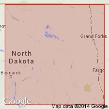
- Williston basin
Summary:
Pg. 19, fig. 6. Bottineau interval (informal) of Madison Group. Defined by mechanical-log deflections or markers. Present in subsurface of the Williston basin, North Dakota. Name applied to lowest of Smith's [1960, AAPG, Rocky Mountain Section Mtg. Abs., Billings, MT] para-time rock units of the Madison. Is essentially equivalent to Lodgepole Formation of other writers in eastern North Dakota. Thickness as much as 670 feet. Lower two-thirds characterized by exceedingly variable lithology and numerous rapid facies changes. Varies from black shale, red and gray calcareous shale, argillaceous limestone, cherty limestone, glauconitic limestone, dolomitic limestone, to dolomite. Limestones are generally clastic and vary from finely crystalline to granular. Porosity ranges from vuggy to fine intergranular. From east to west, facies change from cherty carbonates to argillaceous carbonates, and back to cherty carbonates. Lower part grades into Carrington facies (new), a clastic unit on northeast side of Williston basin, North Dakota. Conformably overlies Bakken Formation; where Bakken is absent is unconformable with older rocks. Underlies Tilston interval (informal) of Madison Group. Age is Early Mississippian (Kinderhookian), based on correlation with equivalent rocks in Canada. Mechanical-log characteristics shown for the Carter Oil Company, E.L. Semling No. 1 well, in sec. 18, T. 141 N., R. 81 W., Oliver Co., ND.
Source: North Dakota lexicon (North Dakota Geol. Survey Rpt. Inv., no. 71); GNU records (USGS DDS-6; Denver GNULEX).
- Usage in publication:
-
- Bottineau interval
- Modifications:
-
- Revised
- AAPG geologic province:
-
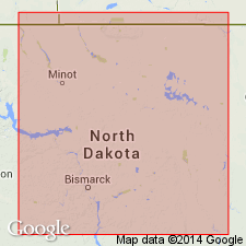
- Williston basin
Summary:
Bottineau interval (informal) in Madison Formation. Recognized in subsurface of the Williston basin, North Dakota. Subdivided into informal subintervals (descending): Flossie Lake, Whitewater Lake, Virden, and Scallion. These units are extended into North Dakota from adjacent parts of Manitoba where they were previously defined as members of the Lodgepole Formation [M.S. Stanton, 1956, Strat. of Lodgepole Formation, Virden-Whitewater area, Manitoba: Jour. Alberta Soc. Petrol. Geol., v. 4, no. 7, p. 164-167]. Overlies Bakken Formation; underlies Tilston interval (informal) in Madison Formation. Age is Mississippian. Boundaries and mechanical-log or lithologic characteristics not shown or described.
Source: Modified from GNU records (USGS DDS-6; Denver GNULEX).
- Usage in publication:
-
- Bottineau interval
- Modifications:
-
- Overview
- AAPG geologic province:
-
- Williston basin
Summary:
Pg. 196-197. Bottineau interval (informal) of Madison Formation. Defined by mechanical-log markers. Present in subsurface of the Williston basin, North Dakota. Several lithologic facies recognized, including central basin, basin flank, crinoidal mudstone, gray shale, open shelf, pelletal grainstone, oolitic grainstone, and lagoonal. Bottineau represents a transgressive sequence from the restricted environment of the Bakken Formation to a maximum inundation and water depth during early Bottineau time, followed by a gradual regression during the remainder of Bottineau-interval deposition. Divided into four subintervals (ascending): (1) Scallion subinterval, normal marine conditions; (2) lower and upper Virden subinterval, gradual marine regression of cyclical nature with variable clastic influx; (3) lower and upper Whitewater Lake subinterval, gradual marine regression of cyclical nature with variable clastic influx; and (4) Flossie Lake subinterval, gradual marine regression. Conformably underlies Tilston interval (informal) of Madison Formation; conformably overlies Bakken Formation or older rocks. Age is Early Mississippian (Kinderhookian). Report includes isopach map.
Source: North Dakota lexicon (North Dakota Geol. Survey Rpt. Inv., no. 71); GNU records (USGS DDS-6; Denver GNULEX).
- Usage in publication:
-
- Bottineau interval
- Modifications:
-
- Areal extent
- AAPG geologic province:
-
- Williston basin
Summary:
Pg. 13. Bottineau interval (informal). Present in [subsurface of] North Dakota. Equivalent strata in southern Manitoba and Saskatchewan are referred to as Souris Valley; in eastern Montana and South Dakota as Lodgepole. Age is Early Mississippian (Kinderhookian). [Name credited?] to M.H. Smith (1960 [abs.], AAPG, Rocky Mountain Section Mtg., Billings, MT) who proposed Lodgepole, Mission Canyon, and Charles as magnafacies of Madison, and subdivided Madison into five para-time rock units.
Source: Publication.
For more information, please contact Nancy Stamm, Geologic Names Committee Secretary.
Asterisk (*) indicates published by U.S. Geological Survey authors.
"No current usage" (†) implies that a name has been abandoned or has fallen into disuse. Former usage and, if known, replacement name given in parentheses ( ).
Slash (/) indicates name conflicts with nomenclatural guidelines (CSN, 1933; ACSN, 1961, 1970; NACSN, 1983, 2005, 2021). May be explained within brackets ([ ]).