- Usage in publication:
-
- Boring Agglomerate
- Modifications:
-
- Overview
- AAPG geologic province:
-
- Western Columbia basin
Summary:
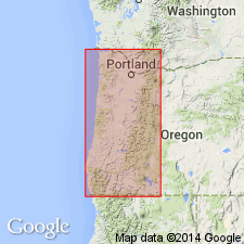
Pg. 5-6. Boring Agglomerate. Originally described by R.C. Treasher, 1942, Geologic map of the Portland area, Oregon, Oregon Dept. Geol. and Min. Ind. map. The Boring Agglomerate is a term sometimes applied to what probably is an equivalent of the Rhododendron Formation in the upper Clackamas Valley in northwestern Oregon near Portland. The unit consists of massive volcanic breccia and lesser amounts of interbedded lava. The breccia consists of angular fragments of basic andesite and boulders of basalt set in a tuffaceous matrix. The Boring Agglomerate is assigned an early Pliocene age in the literature on the basis of its interbedded relationship with the Molalla Formation, which was formerly thought to be of early Pliocene age. Because the Molalla Formation is now considered Miocene in age, a Miocene age is also assigned to the Boring Agglomerate (Rhododendron Formation). Volcanic rocks associated with the Pliocene Troutdale Formation, which are sometimes assigned to the Boring Agglomerate, probably belong to the Boring Lava.
[See also E.M. Baldwin, 1964, Geology of Oregon, Ann Arbor, MI, Edwards Bros., Inc.; W.D. Lowry and E.M. Baldwin, 1952, GSA Bull., v. 63, p. 1-24; R.C. Treasher, 1942, Oregon Dept. Geol. and Min. Ind. Short Paper, no. 7, 10 p.; D.E. Trimble, 1963, USGS Bull. 1119, geologic map (scale 1:62,500).]
Source: Publication.
For more information, please contact Nancy Stamm, Geologic Names Committee Secretary.
Asterisk (*) indicates published by U.S. Geological Survey authors.
"No current usage" (†) implies that a name has been abandoned or has fallen into disuse. Former usage and, if known, replacement name given in parentheses ( ).
Slash (/) indicates name conflicts with nomenclatural guidelines (CSN, 1933; ACSN, 1961, 1970; NACSN, 1983, 2005, 2021). May be explained within brackets ([ ]).

