- Usage in publication:
-
- Boot Rock member
- Modifications:
-
- Named
- Dominant lithology:
-
- Trachyte
- Rhyolite
- AAPG geologic province:
-
- Permian basin
Summary:
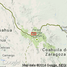
Named as an informal member (1 of 5 members) of the South Rim Formation for a pinnacle named Boot Rock, Brewster Co, TX, Permian basin. These rocks occur in Big Bend National Park. They lie between Pine Canyon (below) and Lost Mine (above) Members of the South Rim in and north of South Rim Mesa. No type locality designated. Is included in a sequence of caldera-related event deposits of South Rim Formation. Consists of two ash-flow tuff facies--the caldera fill (100 m thick) and the outflow (10-20 m thick). The caldera-fill facies consists of multicolored breccia of densely welded glassy matrix containing up to 75 percent quartz trachyte and rhyolite as subangular fragments (1-5 cm diameter). The quartz trachyte is 1-5 percent of anorthoclase and traces of clinopyroxene and fayalite; the rhyolite clasts seem to be of Pine Canyon Rhyolite. The outflow facies is poorly to moderately welded and contains lithic and vitric clasts only in a basal surge deposit. Volume of Boot Rock is 3-5 cubic km. Outflow facies unconformably overlies either the Pine Canyon Rhyolite [Member] or the Chisos Formation, depending on location. Geologic map. Chemical analyses. Was previously included in Wasp Spring Flow Breccia by Maxwell and others (1967). Of Oligocene age.
Source: GNU records (USGS DDS-6; Denver GNULEX).
For more information, please contact Nancy Stamm, Geologic Names Committee Secretary.
Asterisk (*) indicates published by U.S. Geological Survey authors.
"No current usage" (†) implies that a name has been abandoned or has fallen into disuse. Former usage and, if known, replacement name given in parentheses ( ).
Slash (/) indicates name conflicts with nomenclatural guidelines (CSN, 1933; ACSN, 1961, 1970; NACSN, 1983, 2005, 2021). May be explained within brackets ([ ]).

