The National Geologic Map Database is migrating to a new infrastructure. We apologize for any service disruptions during this process.
|
|---|


- Usage in publication:
-
- Boone chert and cherty limestone
- Modifications:
-
- Original reference
- Dominant lithology:
-
- Chert
- Limestone
- AAPG geologic province:
-
- Arkoma basin
Summary:
Pg. xiii, 27-37. [According to p. xiii the formation was named by Branner; the description is by Simonds.] Boone chert and cherty limestone. Characterized by layers of limestone, usually hard, compact, and gray, interbedded with chert, white or gray on freshly broken surface but becoming brownish on exposure. Thickness 150 to 200 feet in Washington County, Arkansas. Underlies Wyman [Batesville] sandstone and overlies Devonian(?) Eureka shale [Chattanooga shale]. [Age is Mississippian (Warsaw and Osage).]
[Named from extensive development in Boone Co., northern AR.]
Source: US geologic names lexicon (USGS Bull. 896, p. 236).
- Usage in publication:
-
- Boone Formation*
- Modifications:
-
- Revised
- AAPG geologic province:
-
- Chautauqua platform
- Cherokee basin
Summary:
Divided into (in ascending order): St. Joe Limestone, Reeds Spring, Grand Falls Chert, Joplin (new), Short Creek Oolite, Baxter Springs (new), and Moccasin Bend (new) Members. St. Joe, Reeds Spring, Grand Falls, and Joplin are of Early Mississippian, Osage age. Short Creek, Baxter Springs, and Moccasin Bend are of Late Mississippian, Meramec age. Area of study is in the Picher field, a mining district which straddles the Oklahoma-Kansas state line just a few miles west of the Missouri state line, on the Chautauqua platform and Cherokee basin. Is 350 to 400 feet thick in the mining field. Consists of fossiliferous limestone, cotton rock (or tripoli), and chert. Underlies, with probable conformity, the Quapaw Limestone (new). Disconformably overlies the Chattanooga Shale of Late Devonian and Mississippian (Kinderhook) age. Report includes isopach map, geologic map, cross section, stratigraphic table.
Source: Modified from GNU records (USGS DDS-6; Denver GNULEX).
- Usage in publication:
-
- Boone Formation*
- Modifications:
-
- Revised
- AAPG geologic province:
-
- Arkoma basin
Summary:
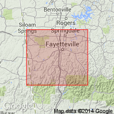
Lower part of Boone Formation revised to include the Walls Ferry as the [basal] bed of the St. Joe Limestone Member of the Boone. [Apparently not stated in this report where exactly the Walls Ferry occurs? GNU staff interpreted (ca. 1987) that the Walls Ferry must be the basal bed of the St. Joe, since it was shown as beneath the St. Joe(?) by Gordon (1964, USGS Prof. Paper 460).] Walls Ferry is a 32 cm-thick, gray to buff-gray, fine-grained limestone that contains a varied invertebrate fauna (e.g., cephalopods, conodonts) which indicate an age of Kinderhook for the lower third (11 cm), and Osage for the upper two-thirds (21 cm). Walls Ferry is usually present where St. Joe is absent or poorly developed. The rest of the St. Joe is a pinkish to reddish-gray, encrinital limestone of Osagean age. Overlying parts of Boone not discussed. Report area is in Independence Co, AR in the Arkoma basin.
Source: GNU records (USGS DDS-6; Denver GNULEX).
For more information, please contact Nancy Stamm, Geologic Names Committee Secretary.
Asterisk (*) indicates published by U.S. Geological Survey authors.
"No current usage" (†) implies that a name has been abandoned or has fallen into disuse. Former usage and, if known, replacement name given in parentheses ( ).
Slash (/) indicates name conflicts with nomenclatural guidelines (CSN, 1933; ACSN, 1961, 1970; NACSN, 1983, 2005, 2021). May be explained within brackets ([ ]).