The National Geologic Map Database is migrating to a new infrastructure. We apologize for any service disruptions during this process.
|
|---|


- Usage in publication:
-
- Bonair conglomerate lentil*
- Modifications:
-
- Original reference
- Dominant lithology:
-
- Sandstone
- Conglomerate
- AAPG geologic province:
-
- Appalachian basin
Summary:
Pg. 3. Bonair conglomerate lentil of Lee formation. Coarse sandstone or conglomerate, 100 to 200 feet thick, forming massive cliffs along west face of table-land from Bonair to Monterey, where it suddenly disappears, apparently breaking down into sandy shale, which can not be distinguished from underlying and overlying shales. At Bonair it rests on 110 feet of shale, which overlies Bonair coal or an underlying Penningston shale. Separated from younger Rockcastle conglomerate lentil of Lee formation by about 125 feet of shale. [Age is Early Pennsylvanian (early Pottsville).]
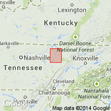
[Named from Bonair (Bon Air, see Pikeville quadrangle, 1892 ed., scale 1:125,000), White Co., central TN.]
Source: US geologic names lexicon (USGS Bull. 896, p. 231).

- Usage in publication:
-
- Bonair sandstone*
- Modifications:
-
- Overview
- AAPG geologic province:
-
- Appalachian basin
Summary:
Bonair sandstone of Lee group. Belongs to Lee group, of [early] Pottsville age. Underlies Vandever shale and overlies Whitwell shale, all formations of Lee group. (See Chartles Butts and W.A. Nelson, Tennessee State Survey Bull. 33-D, 1925.)
Named from Bonair [Bon Air, see Pikeville quadrangle, 1892 ed., scale 1:125,000], White Co., central TN.
Source: US geologic names lexicon (USGS Bull. 896, p. 231).
- Usage in publication:
-
- Bonair sandstone*
- Modifications:
-
- Areal extent
- AAPG geologic province:
-
- Appalachian basin
Summary:
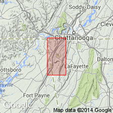
[Bonair sandstone of Lee group.] Geographically extended into northern Georgia where it is 150 to 200 feet thick. Underlies Vandever shale; overlies Whitwell shale. [Age is Early Pennsylvanian.]
Source: US geologic names lexicon (USGS Bull. 1200, p. 423).

- Usage in publication:
-
- Bon Air sandstone[†]
- Modifications:
-
- [Abandoned]
- AAPG geologic province:
-
- Appalachian basin
Summary:
Pg. 4. Sandstone that has been called "Bon Air" at Bon Air, White County, eastern Tennessee, is equivalent to Sewanee conglomerate; because name Sewanee has priority, name Bon Air is discontinued. [U.S. Board on Geographic Names gives Bon Air as correct spelling.]
[Abandoned. See Sewanee.]
Source: US geologic names lexicon (USGS Bull. 1200, p. 422-423).
- Usage in publication:
-
- Bonair Sandstone*[†]
- Modifications:
-
- [Abandoned]
- AAPG geologic province:
-
- Appalachian basin
Summary:
Discussion of Pennsylvanian nomenclature in northwest GA. Rock units renamed according to their correlation with rock units of TN. Johnson (1946) extended name Bonair Sandstone into GA. Present study shows that Johnson's nomenclature is based on miscorrelation with rock units of TN. Sewanee Member of Crab Orchard Mountains Formation of this report is Johnson's Bonair Sandstone. The term Bonair, therefore, not used in northwest GA.
Source: GNU records (USGS DDS-6; Reston GNULEX).
For more information, please contact Nancy Stamm, Geologic Names Committee Secretary.
Asterisk (*) indicates published by U.S. Geological Survey authors.
"No current usage" (†) implies that a name has been abandoned or has fallen into disuse. Former usage and, if known, replacement name given in parentheses ( ).
Slash (/) indicates name conflicts with nomenclatural guidelines (CSN, 1933; ACSN, 1961, 1970; NACSN, 1983, 2005, 2021). May be explained within brackets ([ ]).