The National Geologic Map Database is migrating to a new infrastructure. We apologize for any service disruptions during this process.
|
|---|


- Usage in publication:
-
- Bomoseen grit
- Modifications:
-
- Original reference
- Dominant lithology:
-
- Grit
- AAPG geologic province:
-
- New England province
Summary:
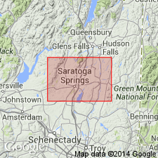
Pg. 69-70 and map. Bomoseen grit. Olive green grit, nearly a pale brick red, in places associated with a bed of quartzite 12 to 55 feet thick. Underlies Mettawee slate in Washington County, eastern New York; in Rensselaer County it underlies Diamond Rock quartzite and overlies Nassau beds --all Lower Cambrian. Thickness 50 to 200 feet.
Type locality: on west side of Lake Bomoseen [Castleton quadrangle, Rutland Co.], southwestern VT. [Recognized in southwestern VT (Bennington and Rutland Cos.) and eastern NY (Washington and Resselaer Cos.).]
Source: US geologic names lexicon (USGS Bull. 896, p. 231).
- Usage in publication:
-
- Bomoseen grit
- Modifications:
-
- Areal extent
- AAPG geologic province:
-
- New England province
Summary:
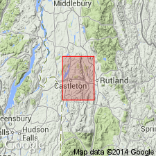
Pg. 46-47, pl. 2. Bomoseen grit crops out along western part of Castleton quadrangle in irregular-shaped pattern from Hampton, New York, at south to point of Pines on western shore of Lake Bomoseen. Kaiser (GSA Bull., v. 56, no. 12, pt. 1, 1945) mapped Bomoseen in outcrop 1 mile west of West Castleton. This outcrop, which is type locality, extends westward into Whitehall quadrangle. Minimum thickness about 200 feet. Underlies Mettawee slate; in many places, gradational contact between the two requires arbitrary definition. Base not exposed, presumably overlies Nassau formation. [Age is Early Cambrian.]
Source: US geologic names lexicon (USGS Bull. 1200, p. 421-422).

- Usage in publication:
-
- Bomoseen Graywacke Member*
- Modifications:
-
- Areal extent
- AAPG geologic province:
-
- New England province
Summary:
Late Proterozoic Nassau Formation is basal part of Taconic allochthon sequence in Glens Falls quad. Includes Bomoseen Graywacke Member and Zion Hill Quartzite Member (exposed on Bird Mountain, VT), and Rensselaer Graywacke Member (exposed just south of quad boundary). Overlain by Cambrian Browns Pond Formation.
Source: GNU records (USGS DDS-6; Reston GNULEX).
For more information, please contact Nancy Stamm, Geologic Names Committee Secretary.
Asterisk (*) indicates published by U.S. Geological Survey authors.
"No current usage" (†) implies that a name has been abandoned or has fallen into disuse. Former usage and, if known, replacement name given in parentheses ( ).
Slash (/) indicates name conflicts with nomenclatural guidelines (CSN, 1933; ACSN, 1961, 1970; NACSN, 1983, 2005, 2021). May be explained within brackets ([ ]).