- Usage in publication:
-
- Bommer member*
- Modifications:
-
- Named
- Biostratigraphic dating
- Dominant lithology:
-
- Sandstone
- Grit
- AAPG geologic province:
-
- Transverse Ranges province
Summary:
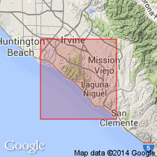
Named as oldest member of Topanga formation for Bommer Canyon which joins Sand Canyon Wash at north margin of San Joaquin Hills. Type area designated in large fault block extending from upper Moro Canyon to mouth of Bommer Canyon [Laguna Beach 7.5' quad] Orange Co, CA. Is predominantly thick-bedded coarse-grained sandstone and grit which contains thin lenticular pebble beds. Thin beds of fine- to medium-grained sandstone commonly separate coarse-grained sandstone beds in middle and upper parts of member. Thickness is not over 2000 ft. Conformably underlies Los Trancos member (new) of Topanga formation; overlies Vaqueros formation. Age is middle Miocene based on TURRITELLA OCAYANA and other middle Miocene mollusks found thoughout unit.
Source: GNU records (USGS DDS-6; Menlo GNULEX).
For more information, please contact Nancy Stamm, Geologic Names Committee Secretary.
Asterisk (*) indicates published by U.S. Geological Survey authors.
"No current usage" (†) implies that a name has been abandoned or has fallen into disuse. Former usage and, if known, replacement name given in parentheses ( ).
Slash (/) indicates name conflicts with nomenclatural guidelines (CSN, 1933; ACSN, 1961, 1970; NACSN, 1983, 2005, 2021). May be explained within brackets ([ ]).

