

- Usage in publication:
-
- Bokchito formation*
- Modifications:
-
- Original reference
- Dominant lithology:
-
- Clay
- Sandstone
- Limestone
- Ironstone
- AAPG geologic province:
-
- Ouachita folded belt
Summary:
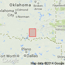
Bokchito formation. Chiefly clay and sandy clay, with beds of friable sandstone, siliceous shell limestone, and iron-stone segregations and concretions. Thickness 140 feet. Underlies Bennington limestone and overlies Caddo limestone. Recognized in southeastern and central southern Oklahoma. Age is Early Cretaceous (Comanche).
[Named from Bokchito Creek, near Bockchito, Bryan Co., central southern OK.]
Source: US geologic names lexicon (USGS Bull. 896, p. 228).
For more information, please contact Nancy Stamm, Geologic Names Committee Secretary.
Asterisk (*) indicates published by U.S. Geological Survey authors.
"No current usage" (†) implies that a name has been abandoned or has fallen into disuse. Former usage and, if known, replacement name given in parentheses ( ).
Slash (/) indicates name conflicts with nomenclatural guidelines (CSN, 1933; ACSN, 1961, 1970; NACSN, 1983, 2005, 2021). May be explained within brackets ([ ]).