

- Usage in publication:
-
- Bluffport marl member
- Modifications:
-
- Named
- Dominant lithology:
-
- Marl
- Clay
- Chalk
- AAPG geologic province:
-
- Upper Mississippi embayment
Summary:
Demopolis chalk subdivided into Bluffport marl member at top in Sumter Co. AL. Bluffport is bed of calcareous, more or less sandy, silty clay about 65 ft thick, that rests on typical Demopolis chalk and gradationally underlies calcareous clayey sand of Ripley formation. Lithology varies from very clayey chalk to compact very chalky clay.
Source: GNU records (USGS DDS-6; Reston GNULEX).
- Usage in publication:
-
- Bluffport marl member
- Modifications:
-
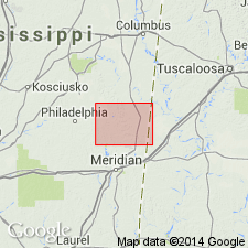
- Areal extent
- AAPG geologic province:
-
- Black Warrior basin
Summary:
Bluffport marl member of Demopolis chalk described in Kemper Co., MS, where it is about 50 ft thick and underlies Ripley formation.
Source: GNU records (USGS DDS-6; Reston GNULEX).

- Usage in publication:
-
- Bluffport Marl Member
- Modifications:
-
- Overview
- AAPG geologic province:
-
- Mid-Gulf Coast basin
Summary:
Bluffport Marl Member in the upper part of the Demopolis Chalk of the Selma Group consists of 50 to 65 ft of massive chalky very dark-gray marl, very clayey chalk, and calcareous clay. The Demopolis is present from the MS State line in southern Pickens Co. to western Bullock Co., MS, where it grades into the Ripley and Blufftown Formations. Age is Late Cretaceous (Campanian-Maastrichtian).
Source: GNU records (USGS DDS-6; Reston GNULEX).
For more information, please contact Nancy Stamm, Geologic Names Committee Secretary.
Asterisk (*) indicates published by U.S. Geological Survey authors.
"No current usage" (†) implies that a name has been abandoned or has fallen into disuse. Former usage and, if known, replacement name given in parentheses ( ).
Slash (/) indicates name conflicts with nomenclatural guidelines (CSN, 1933; ACSN, 1961, 1970; NACSN, 1983, 2005, 2021). May be explained within brackets ([ ]).