


- Usage in publication:
-
- Chautauqua sandstone
- Modifications:
-
- Original reference
- Dominant lithology:
-
- Sandstone
- AAPG geologic province:
-
- Cherokee basin
Summary:
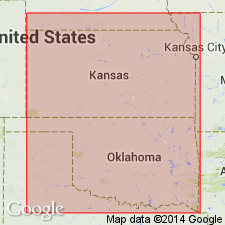
Name credited to G.I. Adams and E. Haworth. Pg. 57-60. The wide zone through which Lawrence shales are exposed, being from 15 to 25 miles wide south of Neosho River, is an exceedingly sandy and hilly country. The sandstones alternating with the softer shales have produced by erosion an irregular topography difficult to describe and unequaled in general irregularity anywhere in state. From Burlington and Neosho Falls to southwest by way of Yates Center, Benedict, New Albany, Buxton, Colfax, Sedan, Peru, and Chautauqua, this sandstone and the corresponding irregular surface occupy the whole country. Doctor Adams has suggested that the sandstone here is sufficiently prominent to merit a distinct local designation, and has proposed for it the name Chautauqua sandstone. The following description of the area is taken from his notebook: Passing south from Neosho River the shales grade into sandstones, so that at Yates Center they become conspicuous, producing the hill on which town is built. The area broadens to south, its eastern border passing west of Buffalo, Fredonla, and Tyro, while its western border runs approximately from Yates Center to Toronto, Fall River, Elk Falls, Sedan and Elgin. To this region the name Chautauqua Sandstone Hills may be here given. The name is already employed somewhat in common usage. These sandstone hills are as characteristic a feature of southeastern Kansas as are the Flint Hills. Age is Pennsylvanian.
Named from Chautauqua Sandstone Hills, which extend through parts of Chautauqua, Woodson, Wilson, Montgomery, Greenwood, and Elk Cos., southeastern KS.
Source: US geologic names lexicon (USGS Bull. 896, p. 407).
- Usage in publication:
-
- Bluejacket sandstone
- Modifications:
-
- Areal extent
- Dominant lithology:
-
- Sandstone
- AAPG geologic province:
-
- Chautauqua platform
Summary:
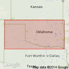
Pg. 541-550. Bluejacket sandstone of eastern Oklahoma, which outcrops just west of Pryor, has been traced south and southeast and mapped by E.A. Trager, W.R. Berger, F.L. Aurin, and D.K. Greger as a sandstone near Warner, [Muskogee County, Oklahoma], which occurs in lower part of McAlester shale. A small trilobite horizon about 70 feet below Bluejacket sandstone near Pryor was found below Warner sandstone in several places. [Age is Pennsylvanian, based on stratigraphic position.]
Source: US geologic names lexicon (USGS Bull. 896, p. 220-221); supplemental information (in brackets) from GNU records (USGS DDS-6; Denver GNULEX).
- Usage in publication:
-
- Bluejacket sandstone member
- Modifications:
-
- Principal reference
- Dominant lithology:
-
- Sandstone
- AAPG geologic province:
-
- Chautauqua platform
Summary:
Pg. 64. Bluejacket sandstone member, 50 to 60 feet thick, occurs near middle of Cherokee shale. It consists sometimes of a solid mass of sandstone but is usually separated into several beds by intervening shales. It is basal sand of Bartlesville group of oil sands. Its base is shown on Miser's geologic map of Oklahoma.
Name first used by D.W. Ohern [1914, Oklahoma Geol. Survey, Norman, OK] in unpublished manuscripts on Nowata and Vinita quadrangles. Named from exposures near Bluejacket, Craig Co., [OK].
Source: US geologic names lexicon (USGS Bull. 896, p. 220-221).
- Usage in publication:
-
- Bluejacket sandstone member*
- Modifications:
-
- Revised
- AAPG geologic province:
-
- Chautauqua platform
- Arkoma basin
Summary:
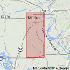
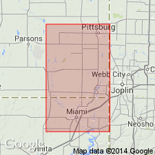
Pg. 503-520. Bluejacket sandstone member, uppermost sandstone member of Savanna sandstone south of Arkansas River, Muskogee County, Oklahoma. Is same as Bluejacket sandstone member of Cherokee shale north of the river, and is here designated Bluejacket sandstone member of Savanna sandstone. Described as massive, medium-textured, friable, very light-brown to almost white color, cross-bedded, irregularly to regularly bedded sandstone. Thickness 40 feet thick in northern part of Muskogee County, separated from underlying Spiro sandstone member by 45+ feet of unnamed shale and Cavanal coal. Thickness 60 feet thick in southern part of Muskogee County, separated from underlying Spiro sandstone member by 110+ feet of unnamed brown shale and Cavanal coal. Underlies Boggy shale. Age is Pennsylvanian. Report includes geologic map, columnar section, stratigraphic table.
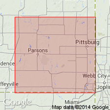
Well exposed along Emachaya Creek near Enterprise, in T. 9 N., R. 18 E., Haskell Co., OK.
Source: US geologic names lexicon (USGS Bull. 896, p. 220-221); supplemental information from GNU records (USGS DDS-6; Denver GNULEX).
- Usage in publication:
-
- Bluejacket sandstone [member]
- Modifications:
-
- Revised
Summary:
Pg. 312-314. Bluejacket sandstone [member] of Boggy shale. Data obtained during 1934 show that Bluejacket sandstone (the surface equivalent of Bartlesville sand) is = lowest sandstone member of Boggy shale, instead of uppermost sandstone member of Savanna sandstone.
Source: US geologic names lexicon (USGS Bull. 896, p. 220-221).
- Usage in publication:
-
- Bluejacket formation
- Bluejacket cyclothem (informal)
- Modifications:
-
- Overview
- AAPG geologic province:
-
- Cherokee basin
Summary:
Pg. 18, 21-22; 1938, Kansas Acad. Sci. Trans., v. 41. p. 193. Cherokee group divided into 15 cyclic formational units. Bluejacket formation (cyclothem), fourth in sequence (ascending), overlies the Columbus and underlies the Knifeton. Average thickness 68 feet. Includes Bluejacket sandstone at base. Age is Middle Pennsylvanian (Des Moines).
Source: US geologic names lexicon (USGS Bull. 1200, p. 397-398).
- Usage in publication:
-
- Bluejacket sandstone
- Modifications:
-
- Areal extent
Summary:
Pg. 27-30, pl. 1. Bluejacket sandstone has been mapped northward from type locality to Oklahoma-Kansas line. Although Bluejacket cannot be traced with certainty as continuous unit in Kansas, name is applied to prominent sandstone exposed just east and south of Columbus. Base of Bluejacket as shown on plate 1 represents base of fairly thick sandstone unit. It was not mapped northeastward beyond sec. 33, T. 32 S., R. 24 E., about 4 miles northeast of Columbus. In places the sandstone is underlain by Rowe coal bed. Term Columbus sandstone was proposed by Haworth and Kirk (1894, Kansas Univ. Quart., v. 2, p. 106) for the sandstone exposed southeast of Columbus but was defined rather loosely and would probably include both Little Cabin and Bluejacket sandstone members. Thickness between 20 and 50 feet. Base is 50 to 100 feet below Weir-Pittsburg coal.
Source: US geologic names lexicon (USGS Bull. 1200, p. 397-398).
- Usage in publication:
-
- Bluejacket sandstone member
- Bluejacket formation
- Modifications:
-
- Principal reference
- Revised
- Dominant lithology:
-
- Sandstone
- AAPG geologic province:
-
- Chautauqua platform
Summary:
Pg. 2087-2091. Type section revised. As originally defined by Ohern (1914, unpub. manuscript), type section of formation includes several sandstone beds, some of which are similar to the Bluejacket, and actual unit called Bluejacket not clearly differentiated. Trace of base of Bluejacket sandstone, as shown on Ohern's unpublished map and on Geologic map of Oklahoma (1926) in vicinity of Bluejacket, Vinita, and Whiteoak, delineates base of sandstone that occurs 30 to 35 feet below the Bluejacket, as here restricted, in type section. Lower sandstone grades into shale southward, and south of Craig County the Bluejacket line on the "Geologic map of Oklahoma" consistently marks base of Bluejacket sandstone as restricted in this paper. Same conditions obtain northward, and Bluejacket sandstone, restricted, is continuous with Columbus sandstone of Haworth and Crane (1898, Kansas Univ. Geol. Survey [Rpt.], v. 3) as mapped by Pierce and Coutier (1937, Kansas Geol. Survey Bull., no. 28 [1938, Kansas Geol. Survey Bull., v. 24]). Bed which apparently should be regarded as Bluejacket sandstone is a well-defined lithologic and mappable unit typically exposed in NE/4 NE/4 sec. 25, T. 27 N., R. 20 E., along road from Bluejacket west to Pyramid Corners, in east slope of Timbered Hill, on Oklahoma Highway 25, in Craig County. In Oklahoma, Bluejacket sandstone is member of Cherokee formation and lies above Little Cabin sandstone member and below Broken Arrow coal member; in Kansas, Bluejacket is formation in Cherokee group and lies between Rowe coal below and Weir-Pittsburg coal above.
Source: US geologic names lexicon (USGS Bull. 1200, p. 397-398).
- Usage in publication:
-
- Bluejacket formation
- Modifications:
-
- Overview
Summary:
Pg. 2748 (fig. 1). Shown on northern midcontinent composite stratigraphic column as Bluejacket formation in Krebs group. Overlies Drywood formation; underlies Seville formation. Age is Middle Pennsylvanian (Des Moines).
Source: US geologic names lexicon (USGS Bull. 1200, p. 397-398).
- Usage in publication:
-
- Bluejacket formation
- Modifications:
-
- Revised
- AAPG geologic province:
-
- Cherokee basin
- Forest City basin
Summary:
Pg. 22 (fig. 5), 39-43, measured sections. Bluejacket formation. Includes beds directly above Dry Wood coal and extending to top of Bluejacket coal. Succession includes Bluejacket sandstone (Ohern, 1914; Howe, 1951) from which formation takes its name. Overlies Dry Wood formation; underlies Seville formation. Krebs subgroup [informal] of Cherokee group.
["Subgroup" not recognized as a formal stratigraphic rank term (CSN, 1933; ACSN, 1961, 1970; NACSN, 1983, 2005, 2021). Considered informal and should not be capitalized.]
Source: US geologic names lexicon (USGS Bull. 1200, p. 397-398).

- Usage in publication:
-
- Bluejacket sandstone
- Modifications:
-
- Overview
Summary:
Shown on chart as Bluejacket sandstone in Krebs formation.
Source: US geologic names lexicon (USGS Bull. 1200, p. 397-398).
- Usage in publication:
-
- Bluejacket Sandstone
- Modifications:
-
- Overview
Summary:
Pg. 35. Bluejacket Sandstone of Krebs subgroup [informal] of Cherokee Group. "Where completely represented, the Bluejacket Formation consists of (ascending): (1) a dark-gray to black, brittle shale with abundant siderite or clay-ironstone concretions; (2) a siltstone or fine-grained, thinly-laminated sandstone; (3) a medium- to fine-grained sandstone which is conglomeratic in many places, the conglomerate pebbles composed of siderite or clay ironstone blisters of shale; (4) an underclay; and (5) the Bluejacket coal bed. Average thickness is approx. 25 feet, but because of cutouts and pinchouts, it is locally absent and apparently is as much as 70 feet thick in some localities" (citing T.L. Thompson, 1995, Missouri Div. Geol. and Land Survey, v. 40 (revised), p. 98). The Bluejacket underlies Seville Formation; overlies Drywood Shale. Age is Pennsylvanian (Desmoinesian). Report includes nomenclature history.
["Subgroup" not recognized as a formal stratigraphic rank term (CSN, 1933; ACSN, 1961, 1970; NACSN, 1983, 2005, 2021). Considered informal and should not be capitalized.]
Source: Publication.
For more information, please contact Nancy Stamm, Geologic Names Committee Secretary.
Asterisk (*) indicates published by U.S. Geological Survey authors.
"No current usage" (†) implies that a name has been abandoned or has fallen into disuse. Former usage and, if known, replacement name given in parentheses ( ).
Slash (/) indicates name conflicts with nomenclatural guidelines (CSN, 1933; ACSN, 1961, 1970; NACSN, 1983, 2005, 2021). May be explained within brackets ([ ]).