

- Usage in publication:
-
- Blue Mountain drift sheet
- [Blue Mountain Drift]
- Modifications:
-
- Original reference
- Dominant lithology:
-
- Till
- AAPG geologic province:
-
- Williston basin
Summary:
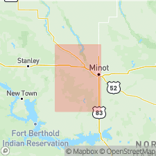
Pg. 125. Blue Mountain drift sheet [Blue Mountain Drift (US geologic names lexicon, USGS Bull. 1350, p. 79).] This drift sheet consists predominantly of gravelly and very sandy clay till. Lignite chips abundant. Extends largely under younger drift over a wide area. Buried oxidized zone has been traced in test holes for nearly 40 miles north and more than 30 miles east of Blue Mountain end moraine in Ward County, North Dakota. [Aerial photograph shows Blue Mountain ground moraine in central part of T. 151 N., R. 87 W., in Ward Co., ND.] Older that Makoti drift sheet. Age is Pleistocene.
[Blue Hill (formerly Blue Mountain) is in secs. 25, 26, 35, and 36, T. 150 N., R. 86 W., eastern edge of Blue Hill 7.5-min quadrangle, northern McClean Co., ND (USGS GNIS database, USGS historical topographic map collection TopoView; accessed Valentine's Day 2013).]
Source: US geologic names lexicon (USGS Bull. 1350, p. 79).
For more information, please contact Nancy Stamm, Geologic Names Committee Secretary.
Asterisk (*) indicates published by U.S. Geological Survey authors.
"No current usage" (†) implies that a name has been abandoned or has fallen into disuse. Former usage and, if known, replacement name given in parentheses ( ).
Slash (/) indicates name conflicts with nomenclatural guidelines (CSN, 1933; ACSN, 1961, 1970; NACSN, 1983, 2005, 2021). May be explained within brackets ([ ]).