

- Usage in publication:
-
- Blue Meadows Tuff Member
- Modifications:
-
- Original reference
- Dominant lithology:
-
- Tuff
- AAPG geologic province:
-
- Great Basin province
Summary:
Pg. 6-7 (fig. 2), 19-20, table 1. Blue Meadows Tuff Member of Isom Formation. A ledge-forming single cooling unit about 8 m thick. Present throughout Markagunt Plateau, southwestern Utah. Upper two-thirds is a dense pale-red plagioclase-magnetite vitric welded tuff low in phenocrysts; has texture and appearance of unglazed porcelain. Lower third is a plagioclase vitric-crystal welded tuff high in phenocrysts. Underlies Baldhills Tuff Member of Isom; at type locality, separated by about 20 m of light-gray volcanic arenite and conglomerate (informal unnamed sandstone member). Overlies Needles Range Formation. Source area unknown. Age is considered latest Oligocene or earliest Miocene; K-Ar date of 25.0 +/-0.4 Ma determined by Fleck and others (this vol.).
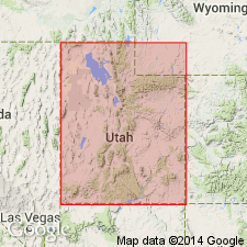
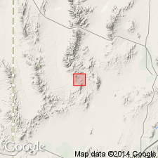
Type locality: northern side of south fork of Sandy Creek, about 11 km NW of Panguitch and east of Blue Meadows (in SE/4 NE/4 sec. 31, T. 33 S., R. 6 W.), Iron Co., southwestern UT. Named from Blue Meadows on Markagunt Plateau, Iron Co., southwestern UT.
[Typographical error: US geologic names lexicon (USGS Bull. 1520, p. 33) lists Rowley and others, 1975, USGS Bull. 1405-B, as the original reference. Should be this publication.]
Source: Publication; US geologic names lexicon (USGS Bull. 1520, p. 33); GNU records (USGS DDS-6; Denver GNULEX).
- Usage in publication:
-
- Blue Meadows Tuff Member*
- Modifications:
-
- Age modified
- AAPG geologic province:
-
- Great Basin province
Summary:
Age of Isom Formation [and members] revised from Oligocene or Miocene to: Oligocene in Great Basin province based on herein adjusted radiometric age of 26 Ma (Fleck and others, 1975).
Source: GNU records (USGS DDS-6; Menlo GNULEX).
For more information, please contact Nancy Stamm, Geologic Names Committee Secretary.
Asterisk (*) indicates published by U.S. Geological Survey authors.
"No current usage" (†) implies that a name has been abandoned or has fallen into disuse. Former usage and, if known, replacement name given in parentheses ( ).
Slash (/) indicates name conflicts with nomenclatural guidelines (CSN, 1933; ACSN, 1961, 1970; NACSN, 1983, 2005, 2021). May be explained within brackets ([ ]).