- Usage in publication:
-
- Blue Hills Granite Porphyry*
- Modifications:
-
- Age modified
- AAPG geologic province:
-
- New England province
Summary:
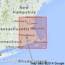
The name Blue Hills [sic] Granite Porphyry is retained although it has been used as Blue Hills Porphyry by Naylor and Sayer (1980); they believe it to be same age as Quincy Granite which Zartman and Marvin (1971) and Zartman (1977) have dated with Cape Ann Complex as Late Ordovician or Early Silurian. [Note: Authors inadvertently used name in this report as Blue Hills Granite Porphyry; plural "Hills" was not intended and should not be used.]
Source: GNU records (USGS DDS-6; Reston GNULEX).

- Usage in publication:
-
- Blue Hill Granite Porphyry*
- Modifications:
-
- Overview
- AAPG geologic province:
-
- New England province
Summary:
Used as Blue Hill Granite Porphyry of Late Ordovician or Early Silurian age. Consists of microperthite-quartz porphyry.
Source: GNU records (USGS DDS-6; Reston GNULEX).

- Usage in publication:
-
- Blue Hills Granite Porphyry*
- Modifications:
-
- Revised
- AAPG geologic province:
-
- New England province
Summary:
[Used mistakenly as Blue Hills Granite Porphyry instead of Blue Hill Granite Porphyry.] On MA State bedrock map of Zen and others (1983), usage of Chute (1966) was followed by mapping volcanic rocks as Mattapan Volcanic Complex instead of Blue Hills [sic] Granite Porphyry. Both units are chemically and mineralogically distinct and most geologists agree that volcanic rocks in Blue Hills area are older than either Quincy Granite or Blue Hills [sic] Granite Porphyry. [Chapters A-J in U.S. Geological Survey Professional Paper 1366 are intended as explanations and (or) revisions to 1:250,000-scale MA State bedrock geologic map of Zen and others (1983).]
Source: GNU records (USGS DDS-6; Reston GNULEX).

- Usage in publication:
-
- Blue Hills Granite Porphyry*
- Modifications:
-
- Overview
- AAPG geologic province:
-
- New England province
Summary:
[Used mistakenly as Blue Hills Granite Porphyry; the plural Hills was not intended and should not be used.] Described as dark gray to dark blue, weathering buff brown to salmon. Assigned a Late Ordovician and Early Silurian age because of its close similarity, both chemically and mineralogically, to Quincy Granite. Cobbles of the rock are found in Early Pennsylvanian Pondville Conglomerate. Bounded by Quincy Granite to the north and east, and by Neponset fault on the west; unconformably overlain by Pondville Conglomerate to the south. [Papers presented as chapters in U.S. Geological Survey Professional Paper 1366 are intended as explanations and (or) revisions to MA State bedrock geologic map of Zen and others (1983) at scale of 1:250,000.]
Source: GNU records (USGS DDS-6; Reston GNULEX).
For more information, please contact Nancy Stamm, Geologic Names Committee Secretary.
Asterisk (*) indicates published by U.S. Geological Survey authors.
"No current usage" (†) implies that a name has been abandoned or has fallen into disuse. Former usage and, if known, replacement name given in parentheses ( ).
Slash (/) indicates name conflicts with nomenclatural guidelines (CSN, 1933; ACSN, 1961, 1970; NACSN, 1983, 2005, 2021). May be explained within brackets ([ ]).

