The National Geologic Map Database is migrating to a new infrastructure. We apologize for any service disruptions during this process.
|
|---|


- Usage in publication:
-
- Blue Canyon Tuff
- Modifications:
-
- Original reference
- Dominant lithology:
-
- Tuff
- AAPG geologic province:
-
- Basin-and-Range province
Summary:
Blue Canyon Tuff of Datil Group. The Blue Canyon Tuff of the Datil Group, here named, is in the Datil Mountains and northwest Gallinas Mountains in southwestern New Mexico. Thins to the east and is absent in the Socorro-Magdalena area. Consists of brown- to purple-gray, unwelded to poorly welded, moderately crystal-rich quartz-latite ash-flow tuff. Is interbedded with the Rincon Windmill Member (new name) of the Spears Formation of the Datil Group and locally splits the Rincon Windmill Member into two tongues. Overlies the Rock House Canyon Tuff (new name) of the Datil Group; underlies the Hells Mesa Tuff. Thickness at the type section is 40 feet and attains 100 feet. [Source unknown.] Age is Oligocene based on a potassium-argon biotite date of 33.3 Ma and a zircon fission-track date of 33.2 Ma.
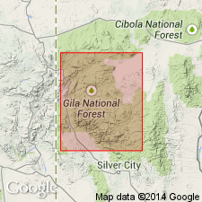
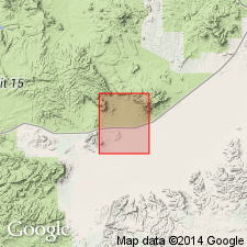
Type section: northwest side of Main Canyon near its junction with Blue Canyon, 7 mi north of Datil, 1.1 mi northeast of junction of Cibola National Forest road 14 and road into Blue Canyon, in NE/4 SE/4 sec. 1, T. 1 S., R. 10 W., Catron Co., NM.
Source: US geologic names lexicon (USGS Bull. 1565, p. 35-36); supplemental information from GNU records (USGS DDS-6; Denver GNULEX).
- Usage in publication:
-
- Blue Canyon Tuff
- Modifications:
-
- Geochronologic dating
- AAPG geologic province:
-
- Basin-and-Range province
Summary:
Has a 40Ar/39Ar age of 33.93 m.y., or [Oligocene] in the Mogollon-Datil volcanic field, Basin-and-Range province.
Source: GNU records (USGS DDS-6; Denver GNULEX).
- Usage in publication:
-
- Blue Canyon Tuff*
- Modifications:
-
- Overview
- Geochronologic dating
- Paleomagnetics
- AAPG geologic province:
-
- Basin-and-Range province
Summary:
Is formation in Datil Group. Is mapped in Horse Mountain West quad, Catron Co, NM in eastern part of Basin-and-Range province. Is typically light-gray to reddish-gray, densely welded, phenocryst-rich, rhyolitic ash-flow tuff with light-gray eutaxitic pumice. Phenocrysts range to as much as 4-5 mm and consist mainly of subequal amounts of glassy sanidine and dull plagioclase, minor biotite and opaque oxide, and traces of conspicuous green clinopyroxene, hornblende, apatite, zircon, and sphene. Aphanitic matrix is locally vitroclastic. Maximum thickness in this quad is about 10-15 m. Natural remanent magnetism determined as follows: mean inclination, -36.9; mean declination, 143.4; polarity, reversed. Isotopic dating: 40Ar/39Ar age is 33.75 Ma, Oligocene.
Source: GNU records (USGS DDS-6; Denver GNULEX).
For more information, please contact Nancy Stamm, Geologic Names Committee Secretary.
Asterisk (*) indicates published by U.S. Geological Survey authors.
"No current usage" (†) implies that a name has been abandoned or has fallen into disuse. Former usage and, if known, replacement name given in parentheses ( ).
Slash (/) indicates name conflicts with nomenclatural guidelines (CSN, 1933; ACSN, 1961, 1970; NACSN, 1983, 2005, 2021). May be explained within brackets ([ ]).