The National Geologic Map Database is migrating to a new infrastructure. We apologize for any service disruptions during this process.
|
|---|


- Usage in publication:
-
- Blue Bluff beds
- Modifications:
-
- First used
- Dominant lithology:
-
- Limestone
- AAPG geologic province:
-
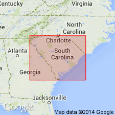
- Atlantic Coast basin
Summary:
Though Siple (1967) referred to the beds overlying the Warley Hill as the McBean Formation, authors are using term Santee because of priority. They informally refer to the light-colored, calcareous part of the section as the "McBean beds," the gray and green, laminated, calcareous part as the "Blue Bluff beds," and the siliciclastic part as the "Tims Branch beds." The Santee is late middle Eocene based on dinoflagellates, calcareous nannofossils, and other taxa.
Source: GNU records (USGS DDS-6; Reston GNULEX).
- Usage in publication:
-
- "Blue Bluff" unit
- Modifications:
-
- Overview
- Revised
- Areal extent
- Biostratigraphic dating
- Dominant lithology:
-
- Calcarenite
- Silt
- Clay
- AAPG geologic province:
-
- Atlantic Coast basin
Summary:
Calcareous strata in the same stratigraphic position as the Santee Limestone but with a distinctive lithology warrants recognition as a separate unit and is referred to as the "Blue Bluff" unit. The informal "Blue Bluff" is a cliff-former and is exposed at several bluffs in GA across the river from the Savannah River site. Extends northwest to at least McBean, GA, and southeast to Barnwell and Allendale, SC. Described as gray and pale green, clayey, laminated calcilutite, calcarenite, and calcareous silts and clays, with shell layers, indurated nodules, thin indurated limestone lenses, calcareous muds, and quartz sand laminae. Interfingers and gradational with the Santee and gradationally over the lower part of the Tinker Creek Formation (new). Correlates in part with the Lisbon Formation of the Gulf Coast. Assigned to zone NP 16 (middle Eocene, middle Claibornian) based on calcareous nannoplankton, palynomorphs, and other taxa.
Source: GNU records (USGS DDS-6; Reston GNULEX).
- Usage in publication:
-
- Blue Bluff Marl
- Modifications:
-
- Biostratigraphic dating
- AAPG geologic province:
-
- Atlantic Coast basin
Summary:
Report contains list of calcareous nannofossil species recorded from the middle and upper Eocene strata in the VSC-4 well. The Blue Bluff, which occupies the interval between 218.6 ft and 136 ft., includes SPHENOLITHUS SPINIGER and DISCOASTER MARTINI, which have LO in NP 16 (middle Eocene). [Authors give no reference or reason for treating the Blue Bluff as a formal unit.]
Source: GNU records (USGS DDS-6; Reston GNULEX).
For more information, please contact Nancy Stamm, Geologic Names Committee Secretary.
Asterisk (*) indicates published by U.S. Geological Survey authors.
"No current usage" (†) implies that a name has been abandoned or has fallen into disuse. Former usage and, if known, replacement name given in parentheses ( ).
Slash (/) indicates name conflicts with nomenclatural guidelines (CSN, 1933; ACSN, 1961, 1970; NACSN, 1983, 2005, 2021). May be explained within brackets ([ ]).