The National Geologic Map Database is migrating to a new infrastructure. We apologize for any service disruptions during this process.
|
|---|


- Usage in publication:
-
- Blounts Creek member
- Modifications:
-
- Original reference
- Dominant lithology:
-
- Clay
- Sand
- Gravel
- AAPG geologic province:
-
- Gulf Coast basin
Summary:
Pg. 118 (fig. 26), 168-170, 174, geol. map. Blounts Creek member, uppermost member of Fleming formation of Grand Gulf group. Consists of group of silty clays and sands; some beds as much as 10 feet thick. Thickness about 500 feet. Overlies Castor Creek member (new); underlies Quaternary deposits. Age is Miocene.
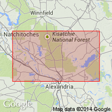
Well exposed south of Hinestone in northern slopes of Blount Creek, Rapides Parish, central LA.
Source: US geologic names lexicon (USGS Bull. 1200, p. 390).
For more information, please contact Nancy Stamm, Geologic Names Committee Secretary.
Asterisk (*) indicates published by U.S. Geological Survey authors.
"No current usage" (†) implies that a name has been abandoned or has fallen into disuse. Former usage and, if known, replacement name given in parentheses ( ).
Slash (/) indicates name conflicts with nomenclatural guidelines (CSN, 1933; ACSN, 1961, 1970; NACSN, 1983, 2005, 2021). May be explained within brackets ([ ]).