The National Geologic Map Database is migrating to a new infrastructure. We apologize for any service disruptions during this process.
|
|---|


- Usage in publication:
-
- Bloomington formation*
- Modifications:
-
- Original reference
- AAPG geologic province:
-
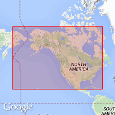
- Central Western Overthrust
Summary:
Pg. 6, 7. Bloomington formation. Bluish gray, more or less thin-bedded limestones and argillaceous shales. Small rounded nodules of calcite are scattered irregularly through many layers of limestone. Thickness 1,320 feet in Blacksmith Fork Canyon, Cache County, northeastern Utah, and 1,162 feet west of Liberty, Bear Lake County, southeastern Idaho. Overlies Blacksmith formation and underlies Nounan formation. Abundant Middle Cambrian fauna.
Type locality: about 6 mi west of Bloomington, Bear Lake Co., southeastern ID. Bloomington Creek, near type locality, passes through formation.
Source: US geologic names lexicon (USGS Bull. 896, p. 214).

- Usage in publication:
-
- Bloomington formation*
- Modifications:
-
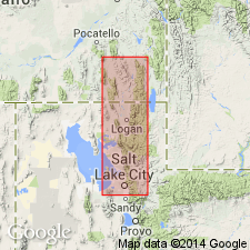
- Areal extent
- AAPG geologic province:
-
- Wasatch uplift
Summary:
Pg. 1110-1112, 1117 (fig. 4), 1121-1122. Bloomington formation. Described in Blacksmith Fork area, Utah, where it is 1,275 feet thick; Hodges member [see Richardson, 1913] about 163 feet thick. Overlies Blacksmith dolomite (emended); underlies Nounan dolomite. [Age is Middle Cambrian.]
[Crops out throughout southeastern Idaho and northeastern Utah as far south as northern margin of Great Salt Lake and Brigham City. Recognized in Lakeside Range, on west margin of Great Salt Lake.]
Source: US geologic names lexicon (USGS Bull. 1200, p. 388).
- Usage in publication:
-
- Bloomington formation
- Modifications:
-
- Revised
- AAPG geologic province:
-
- Great Basin province
- Wasatch uplift
Summary:
Pg. 651-653, 672, 673 (fig. 3). Bloomington formation. Consists of basal tawny-olive shale and interbedded thin layers of light- to dark-gray limestone (Hodges shale member), overlain by middle unit of thinly to thickly bedded, light- to dark-gray limestone about 720 feet thick, overlain by an upper tawny-olive shale unit with some interbedded platy limestone, the Calls Fort member (new). Total thickness 1,495 feet. Overlies Blacksmith dolomite; underlies Nounan formation. [Age is Middle Cambrian.]
[Crops out throughout southeastern Idaho and northeastern Utah as far south as northern margin of Great Salt Lake and Brigham City. Recognized in Lakeside Range, on west margin of Great Salt Lake.]
Source: US geologic names lexicon (USGS Bull. 1200, p. 388).
For more information, please contact Nancy Stamm, Geologic Names Committee Secretary.
Asterisk (*) indicates published by U.S. Geological Survey authors.
"No current usage" (†) implies that a name has been abandoned or has fallen into disuse. Former usage and, if known, replacement name given in parentheses ( ).
Slash (/) indicates name conflicts with nomenclatural guidelines (CSN, 1933; ACSN, 1961, 1970; NACSN, 1983, 2005, 2021). May be explained within brackets ([ ]).