

- Usage in publication:
-
- Blind Bull Formation*
- Modifications:
-
- Named
- Dominant lithology:
-
- Coal
- Bentonite
- Claystone
- Siltstone
- AAPG geologic province:
-
- Green River basin
Summary:
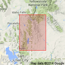
Named for exposures along the divide between Horse Creek and Hoback River, 3 mi north of head of Blind Bull Creek from SW1/4 sec 18, T35N, R115W through S1/2 sec 24 to S1/2 sec 23, T35N, R116W, Afton quad, Lincoln Co., WY in the Greater Green River basin. Replaces use of "Adaville-Frontier formation". Includes coal, bentonite, gray to brown claystone, gray shale, brown siltstone, and sandstone that is partly conglomeratic, gray, calcareous, and gray limestone. Some sandstone beds are poorly sorted and coarse- and medium- to fine-grained. Some sandstone beds are massive. Is 5,083 ft thick at type where it overlies Aspen Shale, and intertongues with and underlies Hilliard Shale. Fossils (mollusks and plants) of Niobrara age identified in several beds at type. Assigned to the Late Cretaceous. Shurtliff Sandstone Member of Hilliard Shale is a southward-extending tongue of Blind Bull.
Source: GNU records (USGS DDS-6; Denver GNULEX).
For more information, please contact Nancy Stamm, Geologic Names Committee Secretary.
Asterisk (*) indicates published by U.S. Geological Survey authors.
"No current usage" (†) implies that a name has been abandoned or has fallen into disuse. Former usage and, if known, replacement name given in parentheses ( ).
Slash (/) indicates name conflicts with nomenclatural guidelines (CSN, 1933; ACSN, 1961, 1970; NACSN, 1983, 2005, 2021). May be explained within brackets ([ ]).