

- Usage in publication:
-
- Blickensderfer Quartz Monzonite*
- Modifications:
-
- Named
- Geochronologic dating
- Dominant lithology:
-
- Quartz monzonite
- AAPG geologic province:
-
- Okanogan province
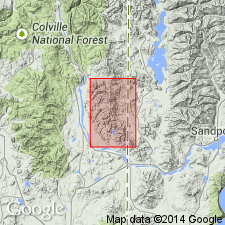
Summary:
Named for Blickensderfer Creek. Type locality designated as exposures in the headwaters of Blickensderfer Creek, sec. 33, T34N R45E, Newport 1 quad, Pend Oreille Co, WA. Composed of light-gray to white coarse-grained muscovite-biotite quartz monzonite. Intrudes Belt Supergroup rocks. Age is Cretaceous from K-Ar ages of 100.3 +/-2.8 and 98.6 +/-2.8 Ma on muscovite samples.
Source: GNU records (USGS DDS-6; Menlo GNULEX).
For more information, please contact Nancy Stamm, Geologic Names Committee Secretary.
Asterisk (*) indicates published by U.S. Geological Survey authors.
"No current usage" (†) implies that a name has been abandoned or has fallen into disuse. Former usage and, if known, replacement name given in parentheses ( ).
Slash (/) indicates name conflicts with nomenclatural guidelines (CSN, 1933; ACSN, 1961, 1970; NACSN, 1983, 2005, 2021). May be explained within brackets ([ ]).